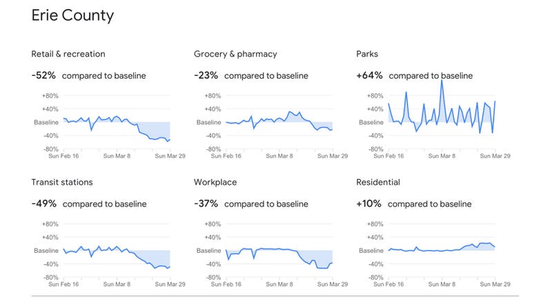
(WBEN) - New numbers made public by Google are helping shed light on the changes communities in Western New York, and across the globe have made to stop the spread of Coronavirus.
Google’s COVID-19 Community Mobility Reports use tracking from apps like Google Maps to see how movement has changed to observe social distancing.
The site, which is updated periodically, shows trends in traffic to retail stores, grocery stores, parks, workplaces and more. The reports show how visits and length of stay at different places change compared to a baseline using the same data used to show popular times for places in Google Maps.
In Erie County, for example, travel to workplaces has decreased 37% compared to the normal rate as of the end of March.
It also shows how people reacted in the days leading up to widespread closures.
In the days before the state closed many non-essential businesses, grocery store traffic was up nearly 40% in Erie county before falling to 23% below normal by the end of the month. In Niagara County, grocery store traffic spiked in mid-March before falling to 15% below normal at the end of the month.
