


RELATED: Are You Ready for the Rain?
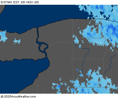
With the warmer air will come rainfall, beginning as light to moderate in intensity late Friday. The National Weather Service predicts the rain will be widespread and come in waves, saying, "the overall intensity of it should largely remain light to moderate, with pockets of some heavier rain embedded within".
A cold front will cross into the region Saturday and lead to periods of moderate to heavy rain late Saturday and Saturday night. The rainfall will likely be near record levels, with meteorologists at the NWS saying totals will be "in the 1-2 inch range with localized higher amounts certainly possible".
Retired Weather Channel guru Tom Niziol says it's an open question as to whether Lake Erie will freeze this year. "Since December 1st, the Buffalo temperature has been running about 5 degrees above normal and we're almost a foot below normal in snowfall."
AccuWeather meteorologists say this is all part of a far-reaching storm system and say, "as a storm develops over the southern Plains on Friday and travels northeastward this weekend, copious amounts of moisture will be drawn northward from the Gulf of Mexico and deposited in the form of heavy rain."
FLOOD WATCH REMAINS IN EFFECT FROM SATURDAY AFTERNOON THROUGH SUNDAY AFTERNOON
* A portion of western New York...including the following counties...Cattaraugus...Chautauqua...Genesee...Monroe... Niagara...Northern Erie...Orleans...Southern Erie and Wyoming.
* From Saturday afternoon through Sunday afternoon.
* Periods of rain will develop across the region, becoming widespread and heavy Saturday afternoon through Saturday night. Total rainfall amounts may reach 1.5 to 2.5 inches, with the greatest amounts expected across the Niagara Frontier.
* Heavy rain falling on nearly saturated ground will result in excessive runoff. This may result in flooding of low lying areas and urban areas. Flooding is also possible on some larger rivers as well, including the Buffalo area creeks.
PRECAUTIONARY/PREPAREDNESS ACTIONS... A Flood Watch means there is a potential for flooding based on current forecasts. You should monitor later forecasts and be alert for possible flood warnings. Those living in areas prone to flooding should be prepared to take action should flooding develop.
HIGH WIND WATCH IN EFFECT FROM LATE SATURDAY NIGHT THROUGH SUNDAY AFTERNOON
* WHAT...Southwest winds 25 to 35 mph with gusts up to 60 mph possible. * WHERE...Niagara, Orleans, Monroe, Erie, Genesee, Wyoming, Chautauqua, and Cattaraugus counties. * WHEN...From late Saturday night through Sunday afternoon.
* IMPACTS...Damaging winds could blow down trees and power lines. Scattered power outages are possible. Shallow rooted trees may be uprooted due to the very wet ground. Minor property damage is possible. Travel could be difficult, especially for high profile vehicles.
LAKESHORE FLOOD WATCH IN EFFECT FROM LATE SATURDAY NIGHT THROUGH SUNDAY AFTERNOON
* WHAT...Lakeshore flooding possible. * WHERE...Lake Erie shore of Erie and Chautauqua counties and the Upper Niagara River.
* WHEN...From late Saturday night through Sunday afternoon.
* IMPACTS...A rapid rise in water levels at the northeast end of Lake Erie may result in lakeshore flooding, including Buffalo Harbor and Canalside, Dunkirk Harbor, and low lying locations along the Upper Niagara River. Water may spray across Route 5 in Hamburg.


