Buffalo, N.Y. (WBEN) - "This is not the most intense snow that's every hit the area," meteorologist Andy Parker tells WBEN Monday afternoon as a band of lake effect snow targets the Buffalo metro and northtowns through the Monday afternoon commute.
"I think the 290 is going to be the worst as far as visibility," Parker tells WBEN of the potential troubles for the afternoon and early evening commute.
A Winter Weather Advisory has now been posted for the metro Buffalo area, all of Erie, Niagara, Orleans, Genesee and Wyoming counties through early Tuesday.
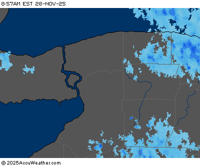
"The snow rate is in the 1 to 2 inch per hour rate," Parker tells WBEN, and he adds that the plows will be able to keep up with the snowfall.
 AccuWeather.com
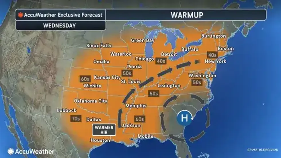
Midweek Warmup
A strong cold front will then cross the eastern Great Lakes Thursday night, bringing strong, gusty winds and a period of rain. Much colder air will pour back into the region Friday with lake effect snow showers.
WINTER WEATHER ADVISORY REMAINS IN EFFECT FROM 10 AM THIS MORNING TO 7 AM EST TUESDAY
* WHAT...Lake effect snow expected. Total snow accumulations 2 to 5 inches in the most persistent lake snows.
* WHERE...Niagara, Orleans, Northern Erie, and Genesee Counties. The greatest accumulations will be across the Buffalo Metro area, southern Niagara, southwest Orleans, and western Genesee counties.
* WHEN...From 10 AM this morning to 7 AM EST Tuesday.
* IMPACTS...Plan on snow covered and slippery road conditions with reduced visibility. The hazardous conditions will impact the Monday evening commute.
PRECAUTIONARY/PREPAREDNESS ACTIONS...
Lake effect snow will fall in relatively narrow bands. If traveling, be prepared for rapidly changing road conditions and visibilities.
WINTER WEATHER ADVISORY REMAINS IN EFFECT FROM 10 AM THIS MORNING TO 7 AM EST TUESDAY
* WHAT...Lake effect snow expected. Total snow accumulations 2 to 5 inches in the most persistent lake snows.
* WHERE...Wyoming and Southern Erie Counties. The greatest accumulations will be from southern Erie County to the ridges of western Wyoming County.
* WHEN...From 10 AM this morning to 7 AM EST Tuesday.
* IMPACTS...Plan on snow covered and slippery road conditions with reduced visibility. The hazardous conditions will impact the Monday evening commute.
PRECAUTIONARY/PREPAREDNESS ACTIONS...
Lake effect snow will fall in relatively narrow bands. If traveling, be prepared for rapidly changing road conditions and visibilities.