


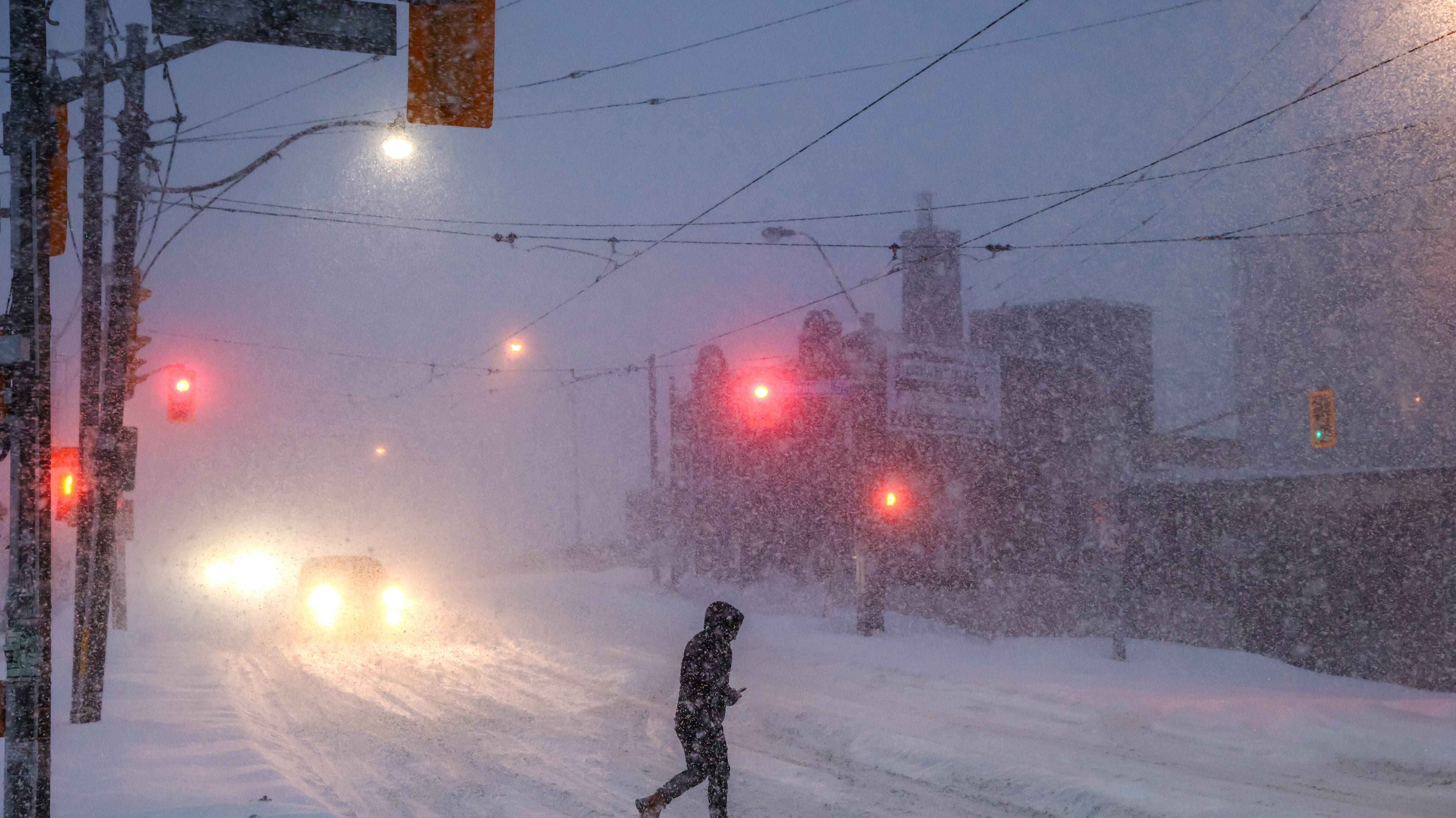
The widespread snow associated with a massive winter storm that impacted much of the US Sunday has ended for the Buffalo-Niagara region, with only some remaining light snow and lake-enhanced snow showers expected through the day Monday
CHECK: WBEN Closings
The dig out from the storm that dropped up to a foot of snow across the region has led a majority of area school districts to close Monday.
"We're done with the heavy snow, all the heavy snow has moved away," National Weather Service meteorologist Jon Hitchcock tells WBEN. "We expect another 1 to 3 inches through today and into this evening for most areas, maybe 3 to 4 inches up near Lake Ontario and parts of Niagara and Orleans counties."
With the extreme cold temperatures in the forecast Monday, road saly won;t be highly effective, Hitchcock says, adding, "Any way you slice it, the roads are going to stay snow-covered today."
A Winter Strom Warning remains posted for Niagara and Orleans counties through Monday evening.
How much snow fell across the region?
"Some of the highest reports we've had have been south of Buffalo, one foot even in West Falls, 10 in West Seneca and Lockport...we had 6.7 at the airport, and we're going to add a few more inches to those totals today," Hitchcock says.
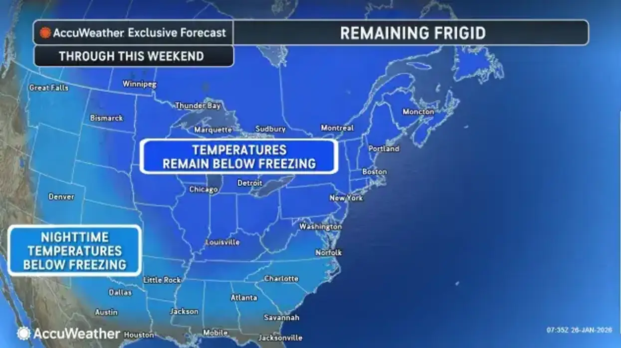
Extreme cold will remain a weather headline for the remainder of the week, Hitchcock says, and it will likely snow some each day during the week.
A reinforcing shot of Arctic air will bring dangerously cold wind chills Monday night through early Tuesday afternoon.
"This is going to be the coldest week of winter," Meteorologist Andy Parker told WBEN. "We had the snowiest week last week. The coldest week this week. Tuesday morning is going to be one of these 'take your breath away mornings."
Parker added that Tuesday and Wednesday may feel the coldest, but Thursday and Friday the air temp will actually be colder. A number of locations won't make it out of the single digits for high temperatures.
A Cold Weather Advisory is posted for ALL of WNY Monday night into Tuesday.
Wind chills will plunge down into the dangerous range across southern Erie, Wyoming, and the western southern tier tonight through early Tuesday afternoon with wind chills expected to bottom out in the -20 to -24 range across the advisory area. Expect wind chills across the remainder of the area to dip down into the -5 to -15 range.
"The good news," Parker said, "is that there will be limited lake effect snow Monday and Tuesday. Some of that will impact the Northtowns and the city of Buffalo. But with Lake Erie 92% frozen, it's starting to put a cap on lake effect. It will be more nuisance snow, rather than big disruptive events."
COLD WEATHER ADVISORY IN EFFECT FROM 10 PM THIS EVENING TO 1 PM EST TUESDAY
* WHAT...Bitterly cold wind chills as low as 20 below zero expected.
* WHERE...Niagara, Orleans, Northern Erie, and Genesee Counties.
* WHEN...From 10 PM this evening to 1 PM EST Tuesday.
* IMPACTS...Bitterly cold wind chills as low as 15 below zero will cause frostbite on exposed skin in as little as 30 minutes.
PRECAUTIONARY/PREPAREDNESS ACTIONS...
This is a potentially hazardous situation to be outdoors. If you must be outside, be sure to cover all exposed skin. Frostbite can occur in 30 minutes or less with apparent temperatures of 15 below zero or colder.
COLD WEATHER ADVISORY REMAINS IN EFFECT FROM 10 PM THIS EVENING TO 1 PM EST TUESDAY
* WHAT...Bitterly cold wind chills as low as 24 below zero expected.
* WHERE...Southern Erie and Wyoming counties and the western Southern Tier.
* WHEN...From 10 PM this evening to 1 PM EST Tuesday.
* IMPACTS...Bitterly cold wind chills as low as 20 below zero will cause frostbite on exposed skin in as little as 30 minutes.
PRECAUTIONARY/PREPAREDNESS ACTIONS...
This is a potentially hazardous situation to be outdoors. If you must be outside, be sure to cover all exposed skin. Frostbite can occur in 30 minutes or less with apparent temperatures of 15 below zero or colder.
WINTER STORM WARNING REMAINS IN EFFECT UNTIL 7 PM EST THIS EVENING
* WHAT...Occasional light snow, with moderate lake enhanced snow along the south shore of Lake Ontario at times. Additional snow accumulations 1 to 3 inches, greatest near Lake Ontario.
* WHERE...Niagara and Orleans Counties.
* WHEN...Until 7 PM EST this evening.
* IMPACTS...Plan on slippery road conditions. The hazardous conditions will impact the Monday morning and evening commutes.
PRECAUTIONARY/PREPAREDNESS ACTIONS...
Widespread accumulating snow will create dangerous travel conditions.
Submit snow reports through our website or social media.
Consider delaying travel. If you must travel, drive with extreme caution. Leave plenty of room between you and the motorist ahead of you, and allow extra time to reach your destination. Avoid sudden braking or acceleration, and be especially cautious on hills or when making turns.

