


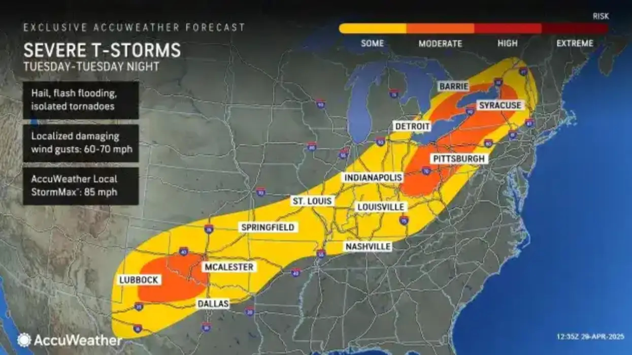

All eyes will be on the potential for severe weather later in the day Tuesday as National Weather Service forecasters warn of the potential for strong winds and potentially severe storms.
The thunderstorms are expected ahead of and with a cold frontal passage, mainly Tuesday afternoon and evening. Some of these thunderstorms may become strong to severe with the greatest threat coming from damaging straight line winds.
The storms will begin to impact the region during the midday hours Tuesday, especially south and east of Buffalo.
"Those storms do have the potential to become strong to severe," NWS meteorologist Dave Thomas tells WBEN.
"The primary hazard will be damaging wind gusts," Thomas says. "Strong enough to bring down a tree or damage siding to a house."
Any thunderstorms may contain heavy downpours as well. "We'll also be on the lookout for some large hail, and possibly even an isolated tornado," Thomas cautions. "The overall threat is a little bit higher compared to other severe weather events, so today will definitely be a day you'll want to be monitoring the weather."
While the threat of an isolated tornado looms, much higher risk will come from potentially damaging straight-line winds, Thomas says. "They could be anywhere between 50 and 60 mph, potentially 70 in the stronger storms."
The storms will pass quickly and we'll be in the clear later Tuesday evening, forecasters say.
"We'll be having a break here tomorrow, it will be cooler on Wednesday, but we'll see rain, showers and thunderstorms re-entering Western New York Thursday, potentially some becoming strong again.