Buffalo, N.Y. (WBEN) - Western New York and the Buffalo-Niagara region are falling into fall this week with the coldest air of the season overspreading the region thus far.
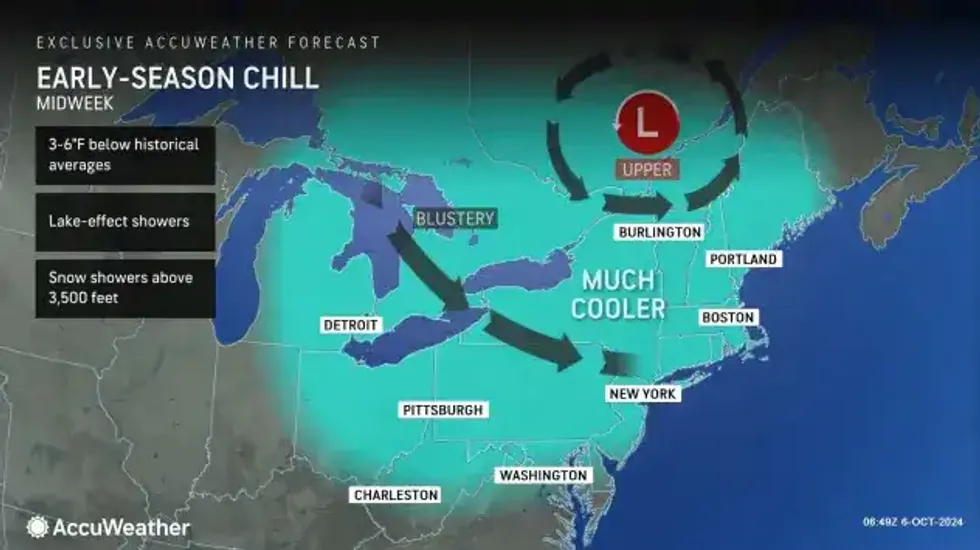
Deep low pressure to the north will allow a much more fall-like pattern to persist through midweek. Expect a day to day cooling trend with daytime temperatures only in the 50s Tuesday through Thursday, and lows at night falling into the 30s across the higher terrain areas. This cooler airmass will also support periodic lake effect rain showers east and southeast of the lakes.
The cooler conditions will stretch through most of the upcoming week. "We are looking at a warmup as we get toward next weekend," National Weather Service meteorologist Phil Pandolfo tells WBEN. "We'll have a little bit more of a fall-like pattern for at least a few days here."
 AccuWeather.com
While not in the cards for the WNY region, snow may actually be in the forecast for the first time of the season in parts of the Northeast. "Some of the higher terrain locations, especially across the Adirondacks and the Green and White Mountains, can experience the first snowflakes of the season on Wednesday and Thursday," said Buckingham.
The possibility of snowflakes will come courtesy of a chilly area of low pressure sweeping south from Canada. It is not out of the question that some higher-elevation residents could awaken to the season's first light coating of snow Thursday morning from northern New York into northern New England. The deeper valleys in the region, however, should stay warm enough for mainly rain showers.