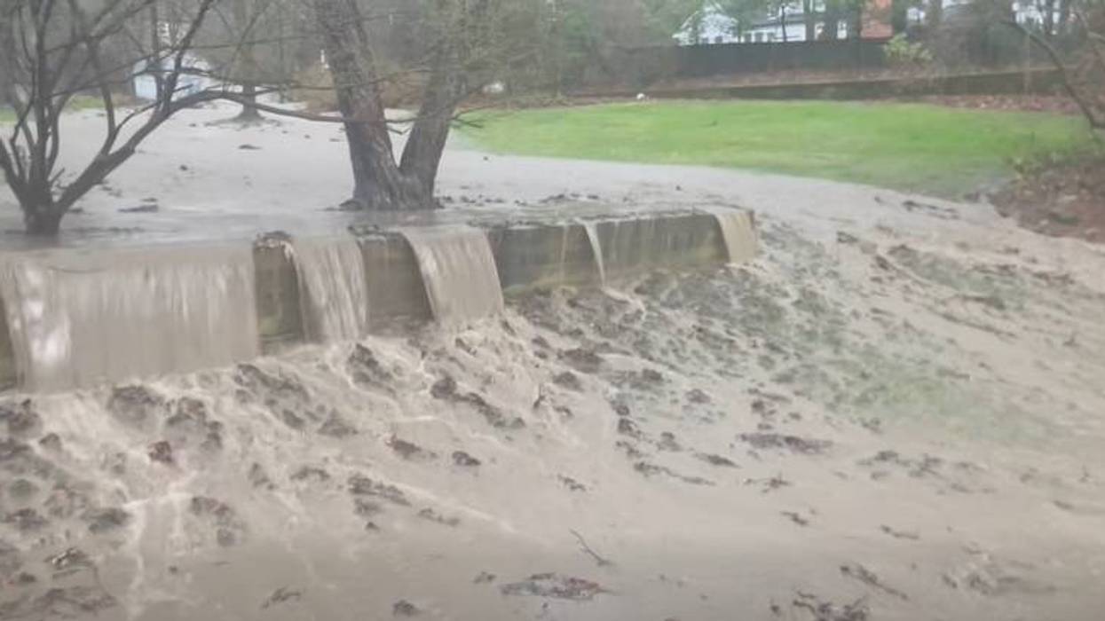
Despite a respite from the drenching and overwhelming Tuesday rainfall across the Buffalo-Niagara and Western New York region, a Flood Watch remains in place for the area, as well as some Flood Warnings in areas where local waterways are threatening their banks.
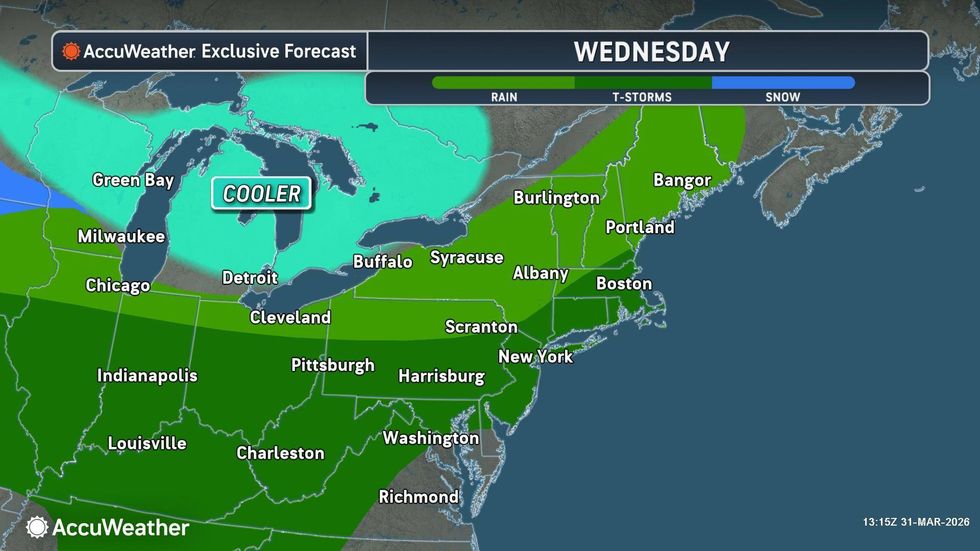
Rain showers today and into the evening hours are expected to be lighter, focusing mainly on the Southern Tier, giving some much needed dry time to the north from recent flooding rains, National Weather Service forecasters say.
"It was a record-breaking day yesterday," NWS meteorologist Dave Thomas tells WBEN. "Over an inch of rainfall at the Buffalo Airport, and most areas actually received 2 to 3 inches of rainfall from late Monday night throughout the daytime on Tuesday."
The Flood Watch remains in place for the southern tier through Wednesday morning , and Flood Warnings are posted for Tonawanda Creek near Rapids Road, Ellicott Creek near Williamsville, as well as Genesee County and Cayuga Creek in Lancaster
The rains did not discriminate by geography Tuesday, leaving flash flooding damage to properties across the region and several road closures as a result of high waters resulting from the deluge of rain.
"For the whole month, it's the second wettest March ever," Thomas notes. "That 1.34 inches yesterday pushed us into second place as far as wettest record for the month of March."
A Tornado Warning was posted for a portion of the southern tier Tuesday, and NWS forecasters are reviewing pictures and vide to help determine if a tornado actually developed or touched-down. "We're actually going to be sending a crew...and make that determination of whether it was a tornado or just straight line wind damage," Thomas says.
Temperatures have cooled into the 40's across the area, but will again rise back to the 60's as the week unfolds.
More rain will return as the week winds down and the weekend approaches, however, withy the chance for heavy rains, thunderstorms and gusty winds.

 AccuWeather.com