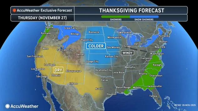
Forecasters are getting more and more confident of a lake effect system that will impact the Western New York region, in general, from late Wednesday through Friday.
National Weather Service forecasters say, however, "There remains a moderate amount of forecast uncertainty in how this event will ultimately play out."
NWS forecasters add that there is a strong indication of an initial period late Wednesday night into Thursday where the wind direction would imply the bands may first set up east to northeast of the lake across the metro Buffalo area, before the bands correspondingly shift southward.
More confidence and detail in the forecasting will come as the new work week unfolds.
While the weekend weather will be seasonably cool, before we get to Thanksgiving, Western New York will actually bask in some milder conditions, forecasters say.
"It's going to warmup to Wednesday," meteorologist Andy Parker tells WBEN. "We might be in the 50's on Wednesday." Thanksgiving Day, Parker says, will be the transitional day to colder air in the 40's and even upper 30's.
Some localized lake effect snow could begin to develop by Thanksgiving Day, and more likely for Black Friday.
"At this point there's no way to pinpoint any location," National Weather Service meteorologist Jim Mitchell tells WBEN. "Or even know if the snow is going to be heavy," Mitchell adds.
Bottom line for any dire predictions of a significant lake effect snow storm following Thanksgiving? It's just too early to tell.
So, relax! For now.
"There's nothing out there that raises heightened concern," Parker says.
