
While parts of the Midwest and Plains states will be feeling a springlike warmup, the moderating temperatures across the Western New York region will be more gradual.
High temperatures through midweek will hover in the upper 30's and lower 40's, National Weather Service forecasters say.
Sunday felt downright balmy across the Buffalo-Niagara region, compared to the single digits and subzero wind chills of just a week ago.
"Much of the Buffalo metro area got into the upper 30's, and even low 40's," NWS meteorologist Phillip Pandolfo tells WBEN. "Here at the airport we reached a high temperature of 39 degrees yesterday(Sunday)."
Temps are expected to be similar to Sunday as the holiday workweek begins.
"A range of upper 30's to low 40's expected for much of the week, so a welcome warmup," Pandolfo says, as he cautions us about a more active weather pattern arriving midweek.
While some light rain is expected overnight into Tuesday, the main active weather pattern arrives for Wednesday, Pandolfo says. More rain will arrive midweek, with the chance, at times, to transition into a more problematic mixed bag at times.
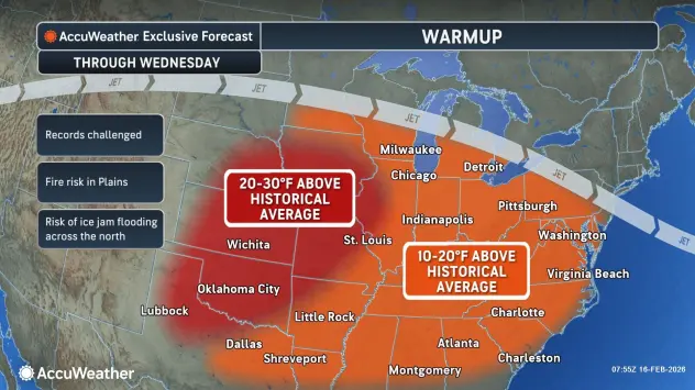
Ice Jam Threat
With the gradual warmup and the added rainfall that is forecast for the region, the threat of ice jam flooding is somewhat of a concern.
"The combination of the widespread rain across the area and these warmer temperatures...we're expecting rainfall amounts of half an inch to an inch...that is certainly going to break up and start to shift the ice on the area creeks and streams," Pandolfo cautions.
Of course it is still winter in Western New York, and we can still expect more cold weather to come.
"The long range models do indicate another seasonably cold stretch is going to arrive, sometime over the weekend, with chances for snow across much of the area."