Just like a switch, the weather across the Buffalo-Niagara region will shift summer to fall beginning Tuesday.
In General, the parched Midwest and Northeast will finally get a drink of water in the form of rain in the coming days, while temperatures will fluctuate wildly from near-record heat to a frosty chill through the week, say AccuWeather meteorologists.
"The extended stretch of dry, summerlike conditions will soon be coming to an end as a cold front is set to sweep in conditions more typical for early October this week, along with some rain," said AccuWeather Meteorologist Brandon Buckingham.
A sharp cold front will then generate some beneficial rainfall as it slowly crosses the region Tuesday and Tuesday evening, National Weather Service meteorologists say.
As rain overspreads the region, amounts will average three quarters of an inch to an inch and a quarter across WNY. Localized higher amounts are possible within thunderstorms, forecasters add.
Due to the frontal passage and widespread showers Tuesday, daytime highs will range from the upper 60's to low 70's, and it will be much cooler Tuesday night with lows in the 40's.
 AccuWeather.com
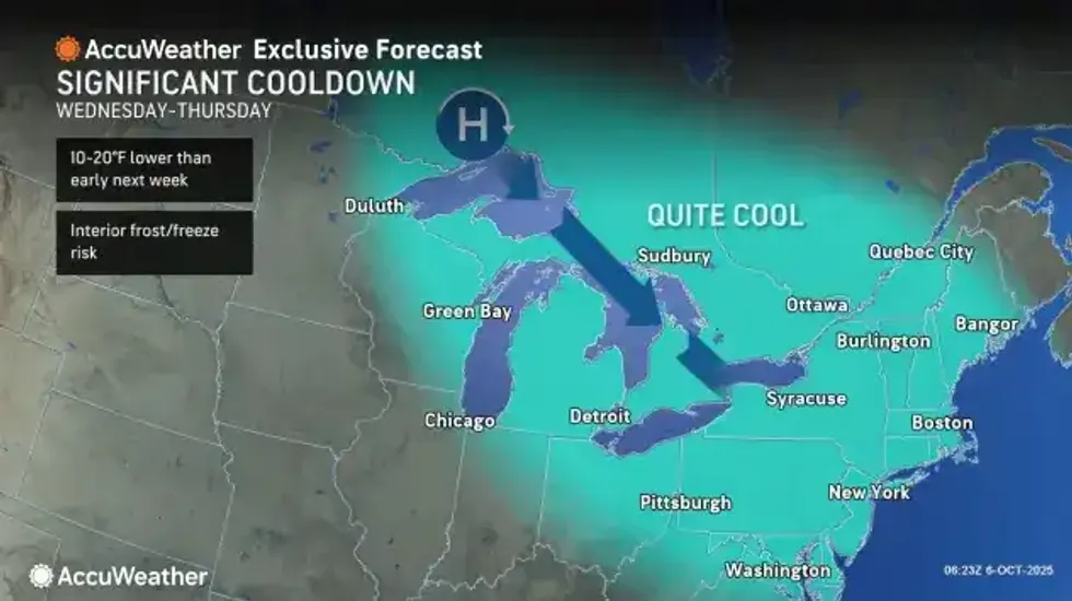
Rain will quickly subside for Wednesday and temps will be much cooler, with daytime highs only in the 50's in most areas both Wednesday and Thursday.
Forecasters are warning of the potential for frost both Wednesday and Thursday nights.
Continued dry weather and a gradual warming trend will then follow for Friday and Saturday as the high slides off the New England coast.