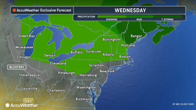

Buffalo, N.Y. (WBEN) - The anticipated lake effect rainfall has landed across the Buffalo-Niagara region, and will remain for the next few days, National Weather Service forecasters say.
"It will remain in place east and northeast of the lake over the next few days," NWS meteorologist Phillip Pandolfo tells WBEN.
While the band of rain will oscillate, similar in fashion to lake effect snow, it will drop significant rainfall across the Buffalo-Niagara region.
"Over the next 24 hours, we're expecting up to about two inches across the Buffalo metro area," Pandolfo says.
The lake effect rain band is expected to shift south of the southtowns late Wednesday and into Thursday, giving the Buffalo metro area a break from the heavy rainfall. The Buffalo metro area could see as much as 3 inches of rain over the course of the next 3 days, however, cautions Pandolfo.
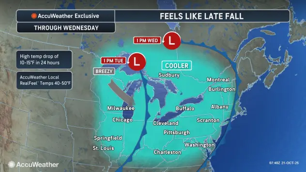
Daytime high temperatures will remain below the seasonal average for the week, topping out mainly in the upper 40's to near 50 degrees.
The lake effect rain will begin to fade away late in the week, Pandolfo predicts. "We expect the lake effect to really start tapering off as we get to Friday night and into Saturday.
AccuWeather Radar for Buffalo metro area

A drier pattern that takes hold late Saturday and into Sunday may hold until Tuesday, Pandolfo says.
What if?
We can only imagine what this lake effect rain might be, if the calendar were a month or so forward and the temperatures were much colder.
"This would amount to feet of snow, at the very least."
So, consider the bright side.