
Following a rain-free, hot and humid Independence Day weekend, the threat of some drenching rainfall and gusty storms looms across the Buffalo-Niagara region Monday, National Weather Service forecasters say.
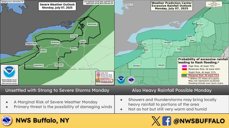
Widespread showers and t-storms will develop ahead of a cold front Monday. Some of these storms could produce strong to damaging winds, and locally heavy rainfall leading to the possibility of flash flooding.
The two periods of time of greatest concern with the frontal passage are, first, during the late morning/early afternoon, and then again late in the day.
The biggest forecast concern remains the potential for localized heavy rainfall and flash flooding, especially given the subtropical airmass.
A secondary concern will be the potential for a couple isolated stronger storms to develop and produce localized strong gusty winds.
In the wake of the front, high pressure and drier/somewhat cooler air will build across the region late Monday through Wednesday, before more unsettled conditions return later on in the week.
Remain weather aware today and stay tuned to NewsRadio 930 WBEN for any updates on a potentially rapidly changing forecast.