Buffalo, N.Y. (WBEN) - When snow and colder air in Buffalo is making news in January, you know it's been a milder winter so far.
There is some more active winter weather for the Buffalo-Niagara region this week, but it's still relatively tame by Buffalo standards.
A band of snow that has impacted areas to the immediate south of the Buffalo metro is expected to drift northward across the area during the day Wednesday, National Weather Service meteorologist Jason Alumbaugh tells WBEN.
"We are expecting it, as the day goes on, to start to drift north and hit more of the metro and even into the northtowns," Alumbaugh tells us. The band will eventually shift southward again late in the day and evening.
Snow accumulations will be marginal by normal January standards, Alumbaugh says. With temperatures right around the freezing mark, totals will be muted. "Maybe 1 to maybe 3 inches locally in the heart of that band."
 AccuWeather.com
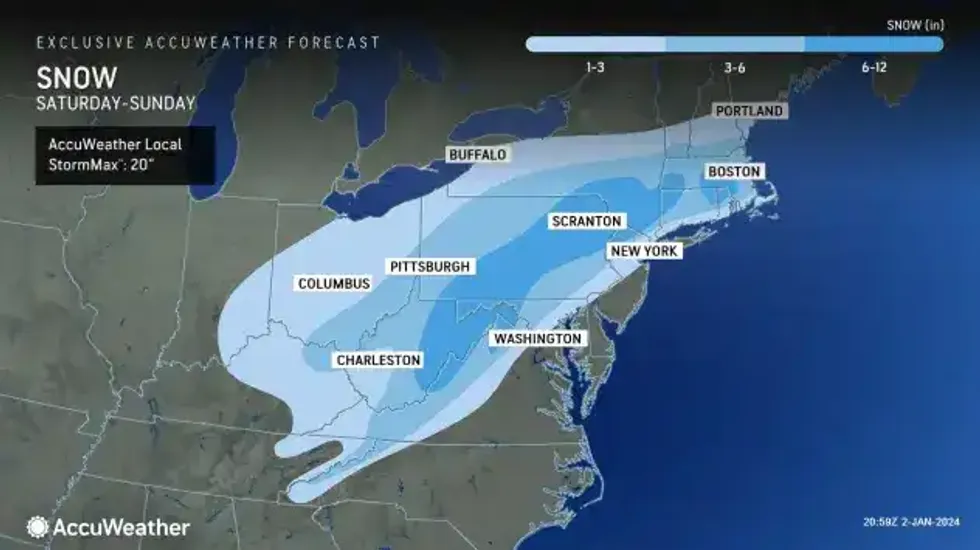
Then all eyes are on the weekend when a nationally advertised storm will target the Northeast. But, Alumbaugh tells us, it's looking more like only a 'brush' with the Buffalo metro area at this time.
The main hit of the weekend storm should be off to our southeast, Alumbaugh tells us. "But we could get a glancing blow of that, especially ares south of here, kind of like the southern tier and more toward the Finger Lakes."
Will the 'on again, off again' pattern finally begin to shift to more 'on' for winter in Western New York?
"The pattern still looks fairly warm ... it looks a little more active ... time will tell."
So far, at least, it's a different winter in Western New York!