


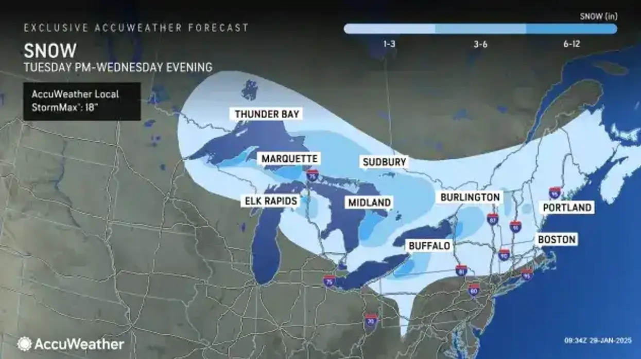
Buffalo, N.Y. (WBEN) - A storm system will produce some fairly widespread snow over the Buffalo-Niagara region Wednesday and a Winter Weather Advisory is posted through 6 p.m.
It was actually a mild overnight into Wednesday morning, National Weather Service meteorologist Liz Jurkowski tells WBEN. "At midnight it was about 38 degrees here at the office," she said. Those temperatures will continue a downward trend through the day Wednesday.
A general snowfall will then impact the Western New York region during the day Wednesday.
How much snow?
"General accumulations across norther Erie, into Niagara frontier, about 1 to 3 inches," Jurkoswki says. "There'll be a few bursts of heavy snow," she adds, with more of the snow then targeting the southern tier, where 3 to 5 inches of snow is likely.
With respect to temperatures, NWS forecasters say they will largely be in the low to mid 30's early Wednesday, then settle back through the 20's this afternoon.
Windy Again!
Wind will again be a factor across the region Wednesday.
"Winds as high as 45 mph...which will cause some blowing and drifting," Jurkowski cautions. Those winds will remain through the day Wednesday. "They'll be slowly dropping off throughout this evening, into overnight tonight."
Warming Trend
Thanks to high pressure reaching northward across our region from Virginia, temperatures will steadily climb into the low to mid 30's Thursday. This should feel even nicer for areas mainly south of a line from Buffalo to Canandaigua where a fair amount of late January sun can be expected, forecasters say.
The mercury will continue to rise Friday, supporting the warmest temperatures we`ve seen for 2025. Highs Friday will warm up into the mid to upper 30's. Due to the warmer airmass Thursday night and Friday, expect a mix of precipitation types, with just plain rain likely across the lower warmer elevations and a mix of snow and rain across the higher elevations.
WINTER WEATHER ADVISORY REMAINS IN EFFECT UNTIL 6 PM EST THIS EVENING
* WHAT...Snow. Additional snow accumulations 1 to 3 inches. Winds gusting as high as 45 mph could produce some blowing snow, especially in open areas. A few brief bursts of heavy snow may move through the area this morning.
* WHERE...Niagara and Northern Erie Counties.
* WHEN...Until 6 PM EST this evening.
* IMPACTS...Plan on slippery road conditions. The hazardous conditions will impact the morning and evening commutes. Gusty winds will down tree branches and cause isolated power outages.
PRECAUTIONARY/PREPAREDNESS ACTIONS...
Periods of snow will result in snow covered roads and limited visibilities. Slow down and use caution while driving.
WINTER WEATHER ADVISORY REMAINS IN EFFECT UNTIL 6 PM EST THIS EVENING
* WHAT...Snow. Additional snow accumulations 2 to 5 inches. Winds gusting as high as 45 mph could produce some blowing snow in open areas. A few brief bursts of heavy snow may move through the area this morning.
* WHERE...Wyoming, Chautauqua, Cattaraugus, and Southern Erie Counties.
* WHEN...Until 6 PM EST this evening.
* IMPACTS...Travel will be difficult with snow covered roads. Areas of blowing snow will significantly reduce visibility. The hazardous conditions will impact the morning and evening commutes.
Gusty winds could down some tree branches and cause isolated power outages.
PRECAUTIONARY/PREPAREDNESS ACTIONS...
Periods of snow will result in snow covered roads and limited visibilities. Slow down and use caution while driving.


