


Buffalo, N.Y. (WBEN) - Hold on spring, winter isn't quite done with Buffalo and Western New York just yet.
After a brief early week warm up, a wintry blast is forecast to cross the region, bringing with it frigid temperatures for this time of year.
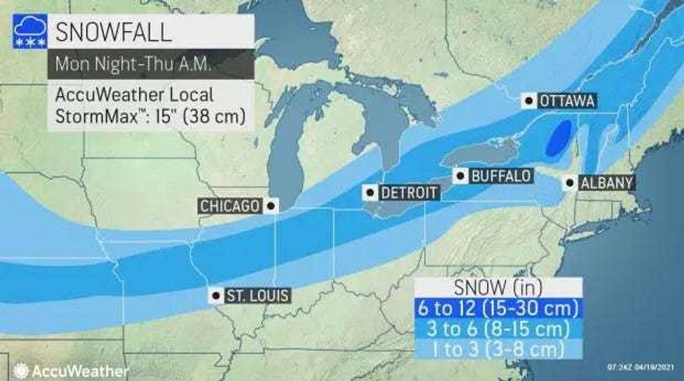
And, yes, it includes SNOW.
AccuWeather says a potent cold front pushing through the Great Lakes late on Tuesday will introduce chilly conditions, just ahead of a wintry storm moving in from the central United States. This first wave of cold air will set the stage for snow to overspread some parts of the Northeast Tuesday night and Wednesday.
Locations along Lake Erie and Lake Ontario, as well as some of the higher elevations from central New York to western Maine, could have several inches of snow by Thursday morning.
How much snow? Forecasters at the National Weather Service are expecting a few inches at least but also caution that the accumulation forecast will be refined as the system develops across the region.
"Conditions from midweek on will have warm weather fans across the Great Lakes and Northeast longing for the unseasonable warmth that was prevalent during the first full week of April," said AccuWeather Meteorologist Mary Gilbert said.
"Instead of temperatures topping out 10-20 degrees above average like what occurred in early April, temperatures from Wednesday to Friday will struggle to even reach levels 10-20 below average," Gilbert added.
The overnight low Wednesday night in Buffalo is expected to reach below freezing with a low of 30 that night, which is almost 30 degrees below normal.
Stay tuned!
 AccuWeather.com


