


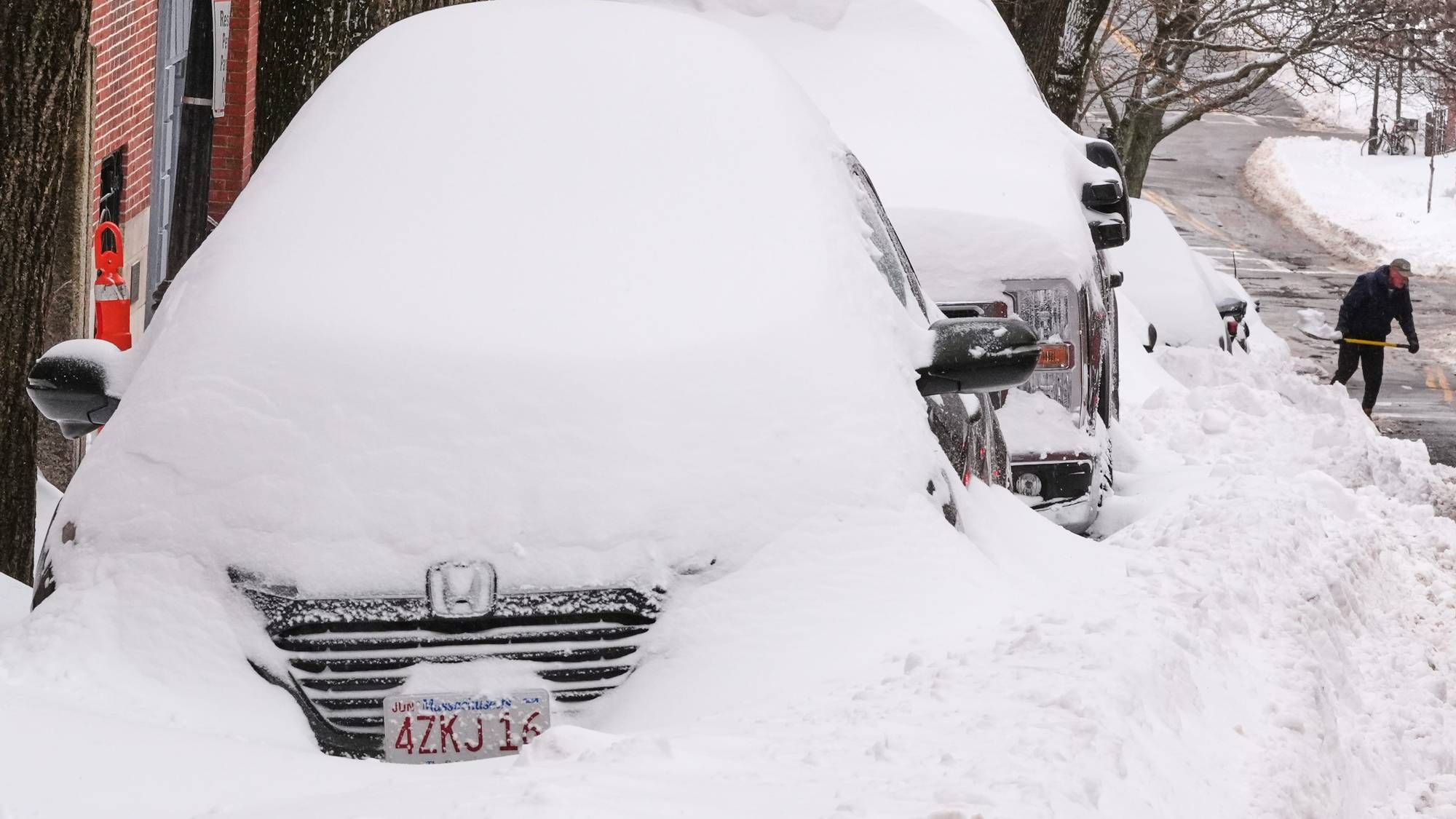
The limited lake effect snow across the Western New York region this week will be more of a nuisance than anything else, especially given the bold cold that continues to grip the region.
CHECK: WBEN Closings
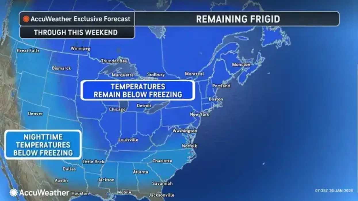
A prolonged period of bitterly cold air will remain in place through the end of the week, National Weather Service forecasters say.
"Different day, same story," NWS meteorologist Jon Hitchcock tells WBEN. "It's a very cold morning out there with wind chills well below zero. It will stay well below zero this morning and then only slightly improve this afternoon."
Southwest winds gusting to 40 mph will be problematic, driving the brutal wind chills much lower than the already bone-chilling cold temps.
A Cold Weather Advisory remains posted through 10 a.m. for the southern tier.
Some limited lake effect snow will fall across the region as well Tuesday. "We're looking at a little bit of fresh snow today, probably just a few inches total through this evening," Hitchcock notes. Extensive blowing and drifting will be somewhat problematic, given the winds.
A Winter Weather Advisory is posted for the Niagara Frontier through Tuesday evening.
There is more cold to come too.
"We're getting another blast of cold air toward the end of the week," Hitchcock cautions. "Thursday night and Friday could be at least as cold, if not a few degrees colder."
How cold? "No better than the teens, and Friday we may struggle to even get to 10," Hitchcock says.
Temperatures will moderate to more seasonable levels and be closer to average by early next week.
Lake Erie Ice Cover
The mostly solid ice cover on Lake Erie will stifle the lake effect activity moving forward, Hitchcock says.
"If the lake were open today, we'd be seeing a lot more heavy snow," Hitchcock says. "With all that ice cover out there, the lake and the weather system moving through can only generate a few inches at most. "If the lake were open, we'd see much, much more snow today."
COLD WEATHER ADVISORY NOW IN EFFECT UNTIL 10 AM EST WEDNESDAY
* WHAT...Bitterly cold wind chills as low as 15 below zero.
* WHERE...The western Southern Tier.
* WHEN...Until 10 AM EST Wednesday.
* IMPACTS...Bitterly cold wind chills as low as 15 below zero will cause frostbite on exposed skin in as little as 30 minutes.
PRECAUTIONARY/PREPAREDNESS ACTIONS...
This is a potentially hazardous situation to be outdoors. If you must be outside, be sure to cover all exposed skin. Frostbite can occur in 30 minutes or less with apparent temperatures of 15 below zero or colder.
WINTER WEATHER ADVISORY REMAINS IN EFFECT UNTIL 10 PM EST THIS EVENING
* WHAT...Lake effect snow and blowing snow. Snow accumulations 2 to 4 inches in the most persistent lake snows. Winds gusting as high as 40 mph will produce considerable blowing and drifting snow, especially in open areas.
* WHERE...The Niagara Frontier.
* WHEN...Until 10 PM EST this evening.
* IMPACTS...Plan on snow covered and slippery road conditions. Areas of blowing snow will significantly reduce visibility. The hazardous conditions will impact the Tuesday morning and evening commutes.
PRECAUTIONARY/PREPAREDNESS ACTIONS...
Lake effect snow will fall in relatively narrow bands. If traveling, be prepared for rapidly changing road conditions and visibilities.


