Buffalo, N.Y. (WBEN) - After the heat and humidity and drenching rains of Saturday, a refreshing pattern switch will overspread the Buffalo and Western New York region as the work week begins.
"Much cooler and less humid weather will last through at least midweek," forecasters at the National Weather Service in Buffalo say. "Outside of some widely scattered, weak lake effect rain showers the next couple of nights and some scattered showers and thunderstorms that look to accompany a weak cold frontal passage on Monday, conditions will also be largely dry."
Daytime high temperatures through Wednesday will be in the comfortable lower to mid 70s with warmer afternoon highs in the 80's forecast later in the week.
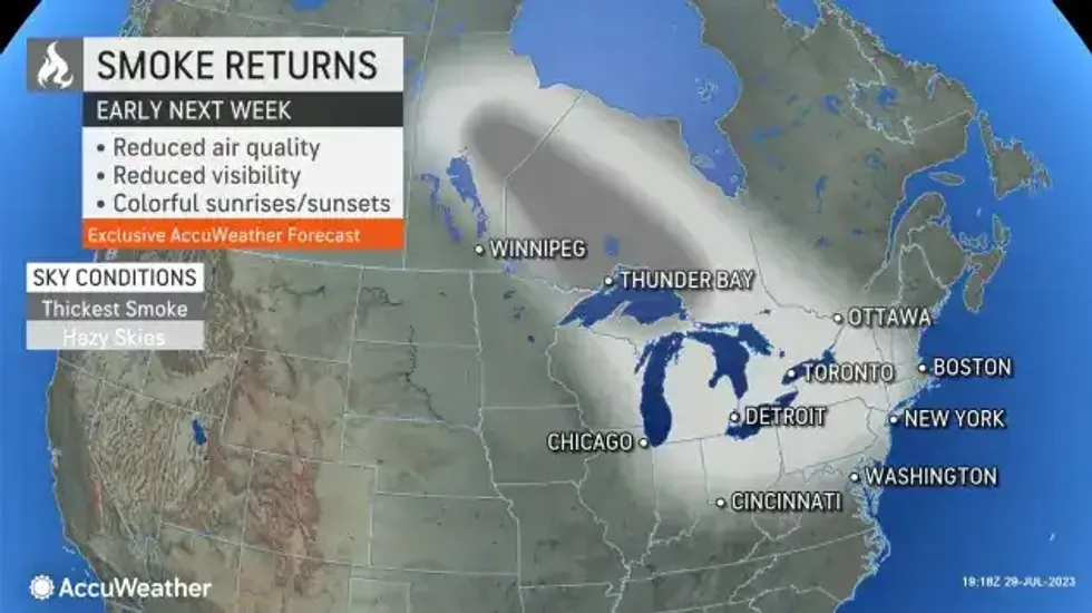
A side effect of the cooler air flow from Canada may be the return of some smoky and hazy conditions from Canadian wildfires.
 AccuWeather.com
On multiple occasions this summer and late this past spring, wildfire smoke from Canadian fires was so thick and low-flying that it brought poor visibility and dangerous air quality to the region.
Smoky conditions over the Midwest and parts of the Northeast next week may range from hazy sunshine overhead to the potential for low-level smoke and unhealthy air quality.