
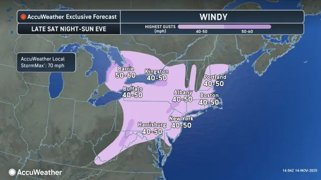
The wind will be what you notice most about the weather across the Buffalo-Niagara region Sunday, with gusts from the northwest as strong as 50 mph at times, National Weather Service forecasters say.
Northwest winds will gust in the 35-45 mph range today into this evening, and then the 25-35 mph range late tonight through Monday, with gusts of 45 to 50 mph possible at times, especially across the southern tier.
A Wind Advisory is posted for much of the region, including Niagara, Orleans, Genesee, Wyoming and Allegany counties
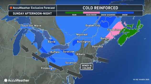
The strong winds from the northwest will form lake effect snow bands that will mainly target areas well to the south and east of the Buffalo metro area, where some moderate accumulations across higher terrain will result.
The heavier snowfall rates and amounts will be closely tied to Lake Huron, which will oscillate back and forth several times from central Chautauqua and southern Cattaraugus counties through Monday.
A Winter Weather Advisory is posted for Chautauqua and Cattaraugus counties, where the highest accumulations could total 4 to 7 inches in some locations.
Only a few passing flurries with minimal accumulation is expected through Monday across the more populated Buffalo metro and suburban areas, forecasters say.
Any lingering lake effect snow Monday will then transition to rain during the daytime hours Tuesday.
High pressure will then build into the region with a return to mainly dry weather by the middle of the week.
WIND ADVISORY IN EFFECT UNTIL 1 AM EST MONDAY
* WHAT...Northwest winds 25 to 35 mph with gusts of 40 to 50 mph.
* WHERE...Niagara, Orleans, Monroe, Wayne, Northern Cayuga, Oswego, Genesee, Wyoming, Livingston, Ontario, and Allegany Counties.
* WHEN...Until 1 AM EST Monday.
* IMPACTS...Gusty winds will blow around unsecured objects. Tree limbs could be blown down and a few isolated power outages may result.
PRECAUTIONARY/PREPAREDNESS ACTIONS...
Use extra caution when driving, especially if operating a high profile vehicle. Secure outdoor objects.
WINTER WEATHER ADVISORY IN EFFECT FROM 10 AM THIS MORNING TO 1 PM EST MONDAY
* WHAT...Lake effect snow expected. Total snow accumulations 4 to 7 inches in the most persistent lake snows across the higher terrain inland from Lake Erie. Winds gusting as high as 45 mph will produce blowing and drifting snow.
* WHERE...Chautauqua and Cattaraugus Counties. The greatest accumulations will be across the higher terrain inland from the Lake Erie shore. Accumulations close to the lake including along the NYS Thruway will be less than an inch.
* WHEN...From 10 AM this morning to 1 PM EST Monday.
* IMPACTS...Travel will be difficult with snow covered roads and poor visibility. The hazardous conditions will impact the Monday morning commute.
PRECAUTIONARY/PREPAREDNESS ACTIONS...
During lake effect snow, the weather can vary from bands of locally heavy snow with greatly reduced visibilities to dry conditions just a few miles away. Be prepared for rapid changes in weather, visibility, and road conditions.