
Buffalo, N.Y. (WBEN) - With much milder temperatures across the Buffalo-Niagara region, comes a wall of wind that will be apparent both Thursday and Friday.
A milder pattern will continue across the region as temperatures will rise into the 40's and lower 50's Thursday as the southerly winds take hold.
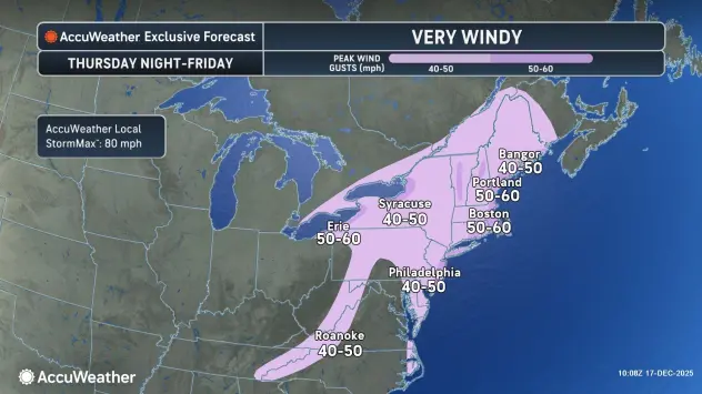
Southerly winds will become very strong along the Chautauqua Ridge Thursday afternoon through evening, with strong southerly winds remaining elsewhere, National Weather Service forecasters say.
Overnight temps into Friday morning will remain mild, in the 40's to near 50 degrees.
A strong cold front will rush through the region late tonight, and strong winds will become westerly Friday through Friday night.
"Winds gusting near 50 mph along the Lake Erie shoreline," WBEN 7 Weather meteorologist Aaron Mentkowski tells us.
A Wind Advisory is posted Thursday afternoon through Friday for the Niagara Frontier, including metro Buffalo.
A High Wind Warning is posted for Chautauqua County Thursday afternoon through Friday.
Much colder air will pour back into the eastern Great Lakes Friday.
The airmass will grow cold enough to support a lake response by late morning or early afternoon, with a brief period of lake effect snow east of the lake. Any lake effect snow that does develop is expected to target areas well south of Buffalo, across the Boston Hills and southern tier.
White Christmas?
So, with this windy warmup, what are our chances for a white Christmas?
"It's looking like less than normal odds for a white Christmas, the way things look now" Hitchcock surmises. "With this big warmup in the next few days, we're going to lose a lot of the snow, if not most of it," National Weather Service meteorologist John Hitchcock told WBEN.
There are a few shots of snow possible going into the pre-Christmas weekend.
But then?
"It warms up again, next week, before Christmas. So, right now, it's not looking too good for a white Christmas."
WIND ADVISORY REMAINS IN EFFECT FROM 3 PM THIS AFTERNOON TO 1 AM EST SATURDAY
* WHAT...Southwest winds 15 to 25 mph with gusts up to 50 mph expected this afternoon through tonight. West winds 20 to 30 mph with gusts up to 50 mph expected Friday through Friday evening.
* WHERE...Erie, Niagara, Orleans, Monroe, Wayne, Northern Cayuga, Oswego, Genesee, Wyoming, Livingston, Ontario, Cattaraugus, and Allegany Counties.
* WHEN...From 3 PM this afternoon to 1 AM EST Saturday.
* IMPACTS...Gusty winds will blow around unsecured objects, including outdoor holiday decorations. Tree limbs could be blown down and a few power outages may result.
PRECAUTIONARY/PREPAREDNESS ACTIONS...
Use extra caution when driving, especially if operating a high profile vehicle. Secure outdoor objects.
HIGH WIND WARNING REMAINS IN EFFECT FROM 3 PM THIS AFTERNOON TO 1 AM EST SATURDAY
* WHAT...Southeast winds 25 to 35 mph with gusts up to 60 mph expected this afternoon through tonight. Southwest winds 20 to 30 mph with gusts up to 50 mph expected Friday and Friday night.
* WHERE...Chautauqua County. The strongest winds will likely be on the northern slope of the Chautauqua Ridge along the Lake Erie shore this afternoon through this evening. The strong winds will be county-wide Friday and Friday night.
* WHEN...From 3 PM this afternoon to 1 AM EST Saturday.
* IMPACTS...Strong winds will blow down trees and power lines.
Scattered power outages are likely. Travel may be difficult, especially for high profile vehicles. The southeast winds will be a crosswind on the New York State Thruway. Strong winds will blow around unsecured objects, including outdoor holiday decorations.
PRECAUTIONARY/PREPAREDNESS ACTIONS...
Avoid being outside in forested areas and around trees. If possible, remain in the lower levels of your home during the windstorm, and avoid windows. Use caution if you must drive.