


Summer just keeps on coming, with high temperatures Sunday more like July and August, not October.
Highs Sunday will be nearly 20 degrees above average, with low to mid 80's in most areas.
Record high temperatures in the lower 80's will be challenged on Sunday in the Great Lakes, and both Sunday and Monday in the Northeast. Such temperatures are 15 to as much as 25 degrees above historical averages for early October, and may mark the last time until next spring that the mercury ventures above the 80-degree mark.
 AccuWeather.com
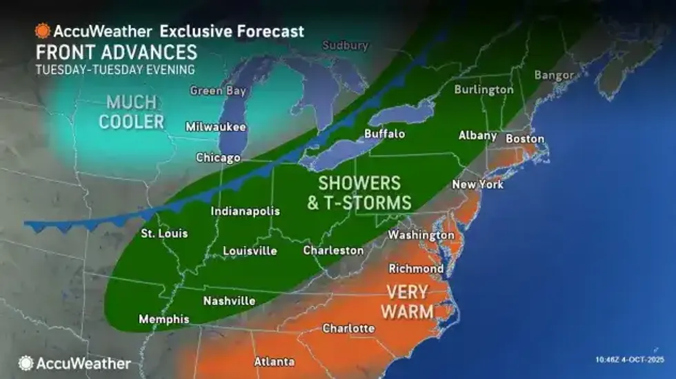
But the summer luck runs out, at least for now, beginning Tuesday, when much-needed rainfall arrives along with more seasonable temperatures.
Dry weather and continued summer- like temperatures will hold out through Monday, National Weather Service forecasters say, before a cold front will then begin to impact the region later Monday night through Tuesday, with chances for widespread showers and even a few isolated thunderstorms ramping up.
"The extended stretch of dry, summerlike conditions will soon be coming to an end as a cold front is set to sweep in conditions more typical for early October next week, along with some rain," said AccuWeather Meteorologist Brandon Buckingham.
 AccuWeather.com
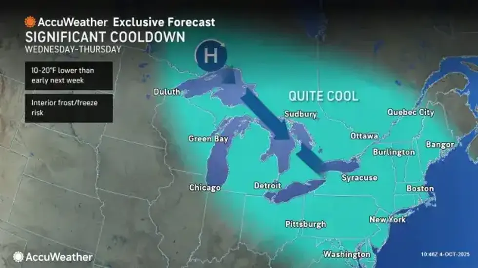
High pressure will move across the region early Wednesday, bringing a quick end to the showers and ushering in high temps expected to be several degrees below average Wednesday, topping out mainly in the 50's to low 60's.
Come mid-month, more cooler weather is in the long range forecast. "There may be a more notable cooling trend around Oct. 15-19," said AccuWeather Senior Meteorologist Merrill. "Global weather patterns are lining up to bring a few days of below- to near-average temperatures and possibly a hard freeze that will end the growing season in parts of the Great Lakes and interior Northeast."


