

Buffalo, N.Y. (WBEN) - Just in time for the weekend, the Buffalo Bills preseason game and the Erie County Fair, a round of unsettled weather looms for the first half of the weekend in Buffalo and Western New York.
There is the potential for some severe weather across the region, however the Buffalo-Niagara region is on the borderline of the potential for a moderate chance of severe weather. "Severe weather looking likely as we break into the warm sector this afternoon," National Weather Service forecasters in Buffalo say.
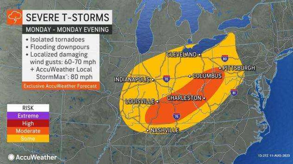
AccuWeather forecasters have outlined two areas where a greater risk of severe weather is likely on Saturday. Within these corridors, severe weather incidents may be more widespread. One zone will be centered on upstate New York and northern Pennsylvania, while the other will focus from southwestern Ohio and southern Indiana to northern Kentucky.
Gusty southwest winds off the eastern end of Lake Erie will help shadow much of the Buffalo-Niagara region from some of the potential for severe weather. Any potential heavier storms would be most likely in the late afternoon hours of Saturday, forecasters say.
A Beach Hazards Statement is posted for the Lake Erie shoreline in Erie County Saturday afternoon as the strong southwest winds will creat high waves and strong currents.
 AccuWeather
"The severe weather potential will extend from western Kentucky up into northern New England where storms will have the potential to bring damaging winds, hail and isolated tornadoes," AccuWeather meteorologist Alex DaSilva said. "With all the recent rainfall in the Northeast, it will not take much for flash flooding to occur along some small streams in the region."
"A few scattered showers may linger into Sunday, however a much quieter finish to the weekend is expected," NWS forecasters say. "Yet another area of low pressure is then set to bring more unsettled weather for the first part of the new work week."