
Saturday will be the better of the two weekend days in terms of outdoor activities, as a large storm system impacts the weather across the Buffalo-Niagara region.
Warmer temperatures are expected both Saturday and Sunday as the region is within the warm zone of a large storm system, National Weather Service forecasters say. Beneficial rain will move through the region from Sunday afternoon into Monday.
After a few morning showers Saturday, conditions will clear and temps will rise to the mid to upper 60's and low 70's, forecasters say.
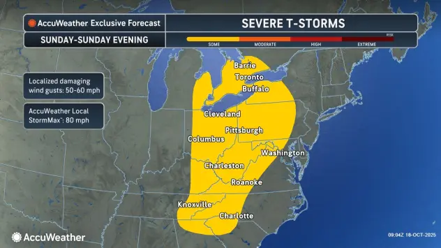
A more active weather week is in store for Western new York, with gusty winds expected for Sunday and Monday as the storm system approach and cross the region.
Sunday will start out dry, before showers become frequent and more steady later in the day and into the evening hours. Rain could be locally heavy with some higher end rainfall amounts near an inch possible.
It will become windy Sunday wind gusts exceeding 30 mph, especially Sunday afternoon and evening. There is also some chance for wind gusts to reach 40 mph, forecasters say.
Sunday temperatures will be warm, in the mid 70's, before returning to normal in the mid 50's and around 60 Monday, when some lingering showers are still possible.