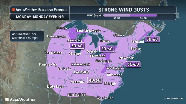

Thunderous winds impacted the Buffalo-Niagara region overnight into Monday morning, and the strong winds will persist Monday, with a Wind Advisory and High Wind Warning extended until 8 a.m. Tuesday.
"We have seen our highest winds," National Weather Service meteorologist Jim Mitchell tells WBEN. "They will come down a bit for this morning. They'll still be gusty, though, up around 40 mph through midday."
The winds will blow a cold front through the region Monday afternoon, bringing with it some rain that will change to snow very quickly Monday evening.
"Maybe toward the tail end of the commute, could see less than a slushy inch or so, but shouldn't be a big deal as far as the roads go," Mitchell predicts.
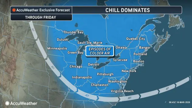
Temperatures will plummet through the day, ending up around the freezing mark by sunset.
"Temperatures just continue to drop overnight," Mitchell says. "Most areas will be down into the teens as we go into the early morning tomorrow."
While it will feel winter-like, the snow will be minimal, with only minor accumulations in spots through tonight, before things dry out, with the exception of some lake effect snow that will develop across the southern tier.
Only a slight and gradual warmup is in sight. "Our coldest day will be Tuesday, that is going to be a real chilly day, probably won't see highs getting above the mid 20's," Mitchell says. "But then we'll have a gradual warmup. Nothing really warm, but we'll go into the 30's on Wednesday, and then we'll be into the 40's for Thursday and Friday."
For now, we're stuck in a nasty March weather cycle, it seems.
"We just keep going like, 'wash, rinse, repeat'," Mitchell quips. "That's pretty typical for March to go up and down. That's spring."
Related

WIND ADVISORY REMAINS IN EFFECT UNTIL 8 AM EDT TUESDAY
* WHAT...South winds 20 to 30 mph with gusts up to 50 mph expected this morning. Winds will become southwest late this morning and gusts 40 to 50 mph are expected through tonight.
* WHERE...Niagara, Orleans, Monroe, Northern Erie, and Genesee Counties.
* WHEN...Until 8 AM EDT Tuesday.
* IMPACTS...Gusty winds will blow around unsecured objects. Tree limbs could be blown down and a few power outages may result.
* ADDITIONAL DETAILS...A lull in the strong winds is expected behind a strong cold front this afternoon. Winds will ramp back up this evening.
PRECAUTIONARY/PREPAREDNESS ACTIONS...
Use extra caution when driving, especially if operating a high profile vehicle. Secure outdoor objects.
HIGH WIND WARNING REMAINS IN EFFECT UNTIL 8 AM EDT TUESDAY
* WHAT...South to southeast winds 25 to 35 mph with gusts up to 60 mph expected early this morning. Winds become southwest later this morning with gusts up to 50 mph expected.
* WHERE...Chautauqua and Southern Erie Counties. Strongest gusts are expected along the northwest downslope region of the Chautauqua Ridge and to the Lake Erie shoreline this morning. Southwest winds later this morning will be across southern Erie and western Chautauqua counties.
* WHEN...Until 8 AM EDT Tuesday.
* IMPACTS...Strong winds will blow down trees and power lines.
Scattered power outages are expected. Travel will be difficult, especially for high profile vehicles.
PRECAUTIONARY/PREPAREDNESS ACTIONS...
Avoid being outside in forested areas and around trees. If possible, remain in the lower levels of your home during the windstorm, and avoid windows. Use caution if you must drive.