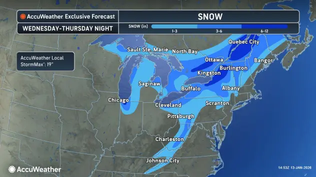

It was only a matter of time before wintry conditions would return to the Buffalo-Niagara and Western New York region in mid-January.
Colder temperatures and a return to snow are in the forecast Wednesday, with a Winter Weather Advisory posted for southern Erie County and the southern tier through Thursday.
A strong cold front will result in rain showers changing to snow Wednesday.
Accumulating snow is expected late Wednesday across the higher terrain south of Buffalo, then across the rest of the region Wednesday night. Widespread snow will transition to localized lake effect snow late Wednesday night.
In addition to the snow, the arctic airmass combined with a fresh northwesterly breeze will lead to wind chill values near or below zero Thursday and Thursday night.
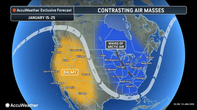
Following a period of more seasonable temperatures Friday and Saturday, the frigid air will make a strong return early next week.
WINTER WEATHER ADVISORY IN EFFECT FROM 11 AM WEDNESDAY TO 1 AM EST FRIDAY
* WHAT...Snow expected. Total snow accumulations 4 to 7 inches. The highest amounts will be across the Chautauqua Ridge and Boston Hills. Wind chills below zero are expected Thursday and Thursday night.
* WHERE...Wyoming, Chautauqua, Cattaraugus, and Southern Erie Counties.
* WHEN...From 11 AM Wednesday to 1 AM EST Friday.
* IMPACTS...Travel will be difficult. The hazardous conditions will impact the Wednesday evening and Thursday morning commutes.
PRECAUTIONARY/PREPAREDNESS ACTIONS...
Periods of snow will result in snow covered roads and limited visibilities. Slow down and use caution while driving.