Thousands remain without power Monday morning after severe weather rolled through the state Sunday afternoon and evening. Call that the appetizer for some more stormy weather late on Monday.
WCCO-TV Chief Meteorologist Chris Shaffer says another hot and humid day is on tap, and that will give way to more storms during the afternoon into the overnight depending on where you are in the state.
"We're gonna watch it blossom in the Dakotas and then race toward the east," Shaffer said on the WCCO Morning News with Tom Hauser. "So, we'll see it jump into western Minnesota where there's still an enhanced risk. So if you live in Alexandria or areas pushing south, not quite down to the border, but west-central Minnesota per se, that's where it'll be at its worst."
An enhanced risk is a about as serious a warning ahead of storms that the National Weather Service issues in the state. The risk factor is a 4 out of 5 making it obviously a dangerous weather situation.
Shaffer does add this is not necessarily a storm that will produce tornadoes - even though that is always possible with these kinds of storms. High winds and an extreme amount of rain is the main threat with what forecasters refer to as a derecho.
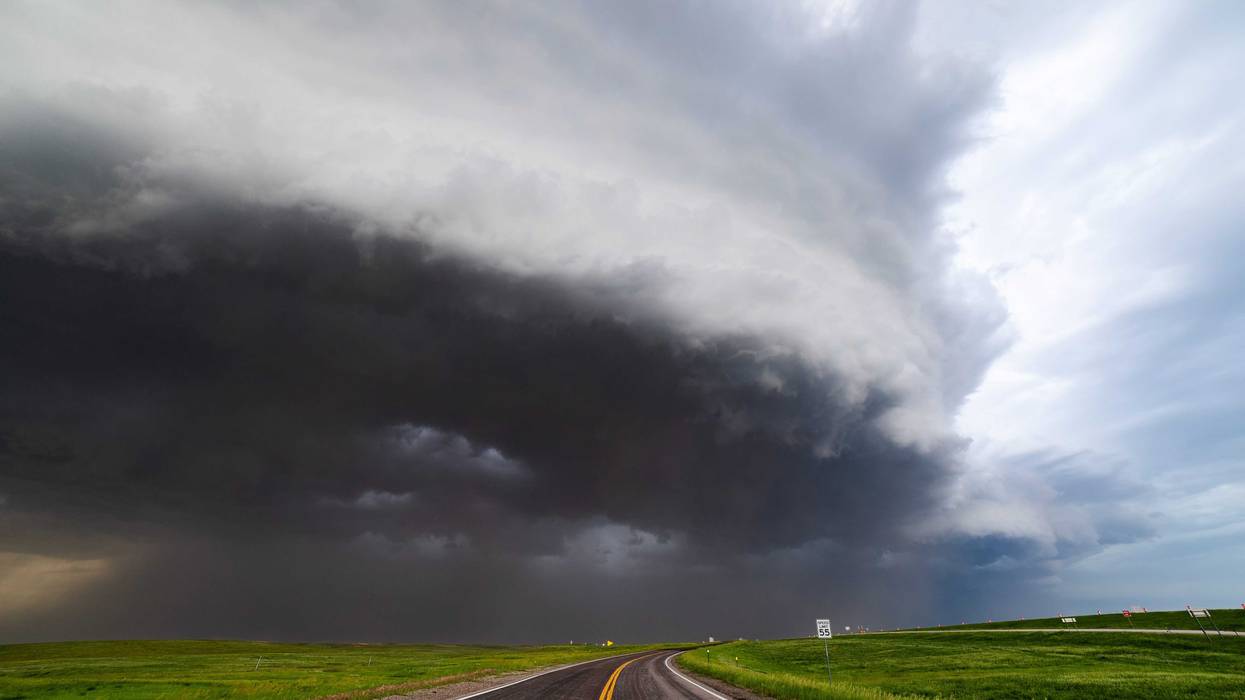
"That enhanced risk, they don't throw this term out there very often, but the potential for a derecho exists," notes Shaffer. "And that's essentially a strong wind event where the winds could gust to 75 MPH. And this storm could be sustained, causing wind damage for 240 or more miles."
If you're scrambling for your phone to Google "derecho," here's a quick primer according to the Weather Channel:
"A widespread, long-lived wind storm that is associated with a band of rapidly moving showers or thunderstorms. Although a derecho can produce destruction similar to the strength of tornadoes, the damage typically is directed in one direction along a relatively straight swath. As a result, the term "straight-line wind damage" sometimes is used to describe derecho damage. By definition, if the wind damage swath extends more than 240 miles and includes wind gusts of at least 58 mph or greater along most of its length, then the event may be classified as a derecho."
In a word, these are dangerous storms. Even if they aren't necessarily tornadic, the straight-line winds these storms are capable of producing can do some damage.
We've seen our share of derecho events even if you've never heard the term. Minnesota is known to produce them every couple of years, but they're more common in the southern parts of the Midwest like Oklahoma, Kansas, Missouri and Arkansas, and also just to our southeast in Illinois and Indiana.
To form, they require stronger winds aloft and hot and muggy conditions in an area where the atmosphere is "capped" (a thin layer of warmer air in the low to mid levels that can inhibit upward vertical motion needed for thunderstorm updrafts). The hot and muggy we definitely have covered on Monday. Temps will be in the 90s across the region with more humidity, just not quite as much as there was over the weekend.
The NWS says they can be much harder to forecast because of the combination of ingredients they form in, but it's certainly possible Monday night in western Minnesota.
Those storms will weaken somewhat as they travel to the east, eventually getting into western Wisconsin overnight.
Shaffer does add that the heavy rain associated with these storms could become a major issue.
"That's a big problem for areas that had the heavy rain last night, because your ground is pretty saturated and can't take much more," he told Hauser. "So we'll have some flooding issues."
There's good news here if you're a little worn out with the heat and humidity. These storms usher in much cooler, drier air.
"Tuesday will still be humid, but cooler with a high of 84," Shaffer adds. "That's pretty close to average this time of year. And then I think a lot of people are really gonna love this Wednesday, Thursday, Friday, Saturday, Sunday. Not humid, highs in the upper 70s."
In the meantime on Monday, there's more heat to contend with and the National Weather Service has now issues another heat advisory.
HEAT ADVISORY IN EFFECT FROM 2 PM TO 8 PM CDT
* WHAT...Heat index values up to 100 expected.
* WHERE...Sibley, Anoka, Carver, Dakota, Hennepin, Ramsey, Scott, Washington, Le Sueur, and Rice Counties.
* WHEN...From 2 PM this afternoon to 8 PM CDT this evening.
* IMPACTS...Hot temperatures and high humidity may cause heat illnesses.