


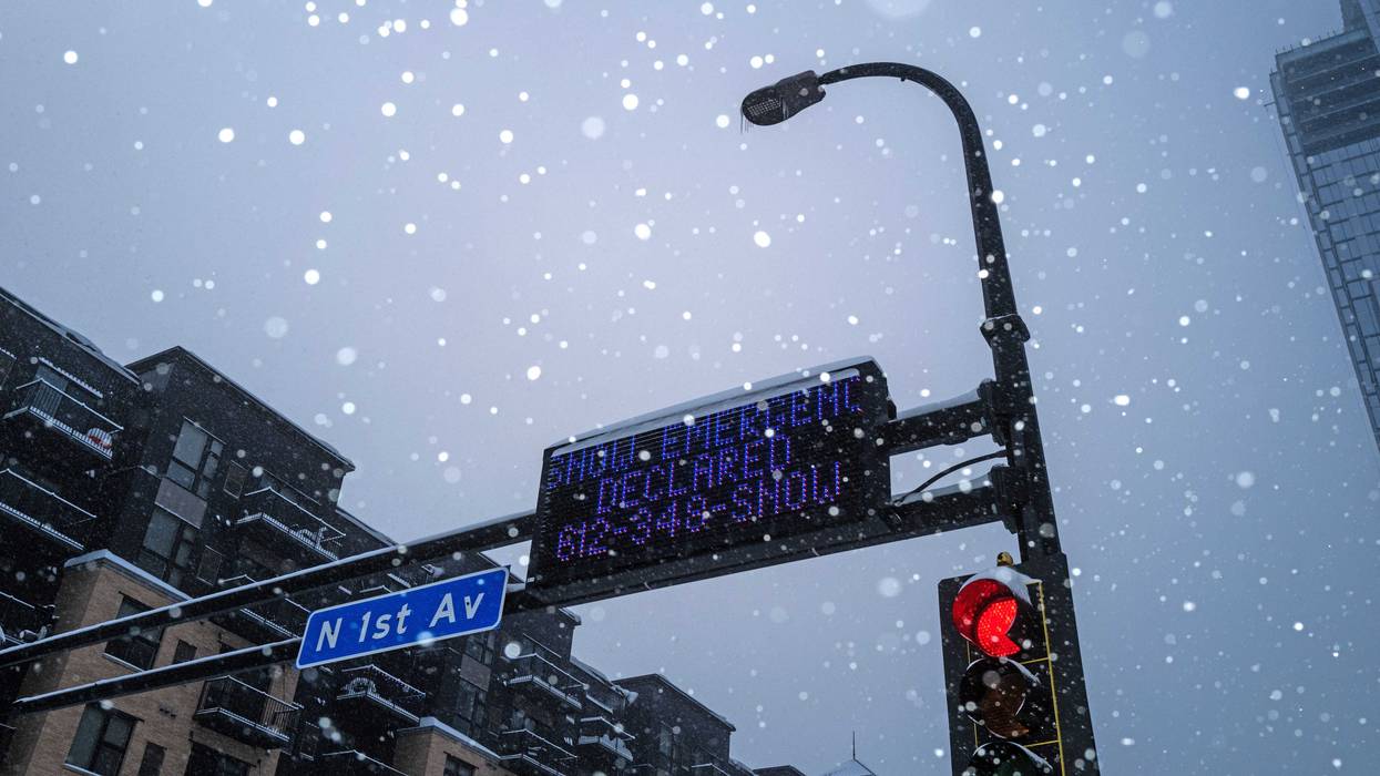
Good news for winter lovers. But for the rest? Not so much.
The National Oceanic and Atmospheric Administration (NOAA) has released its annual winter outlook and the mild winters Minnesota experienced the last two years appear to be distant memories.
For Minnesota, the NOAA outlook is showing a greater than average chance for more snow and colder temperatures in December, January and February.
WCCO-TV Meteorologist Mike Augustyniak says not so fast, however. He says the outlook is based on the forecast for weak La Niña conditions. Those can bring weeks-long stretches of both cold air and mild air in equal parts. NOAA also added they have "low confidence" in the forecast due to the weak La Niña. Not all La Niña winters are cold and snowy.
"It producers a volatile, weaker jet stream," explains Augustyniak. "And what that means is, instead of blowing strongly across Canada and keeping a lot of cold air locked up to the north, it can wiggle more. And every time it wiggles down over the Upper Midwest, we get a cold surge. Every time it wiggles back up, we get a warm surge."
If you want warm, definitely head south. The NOAA Climate Prediction Center's latest outlook anticipates warmer-than-average temperatures for much of the contiguous U.S., although southern states will most likely experience a drier and warmer winter than usual.
Northern states are expected to be cooler and wetter.
Both La Niña and El Niño, which is the cycle's "warm phase," can have a strong influence over weather conditions in North America. When La Niña is active, which is will be through February of 2026, it typically brings drought to southern parts of the country and flooding rains to the Pacific Northwest and Canada, according to data from NOAA.
During winter months, La Niña often leads to warmer and drier conditions in the South and cooler conditions across the North. That can also come with greater amounts of precipitation although the prediction doesn't necessarily predict snow amounts.
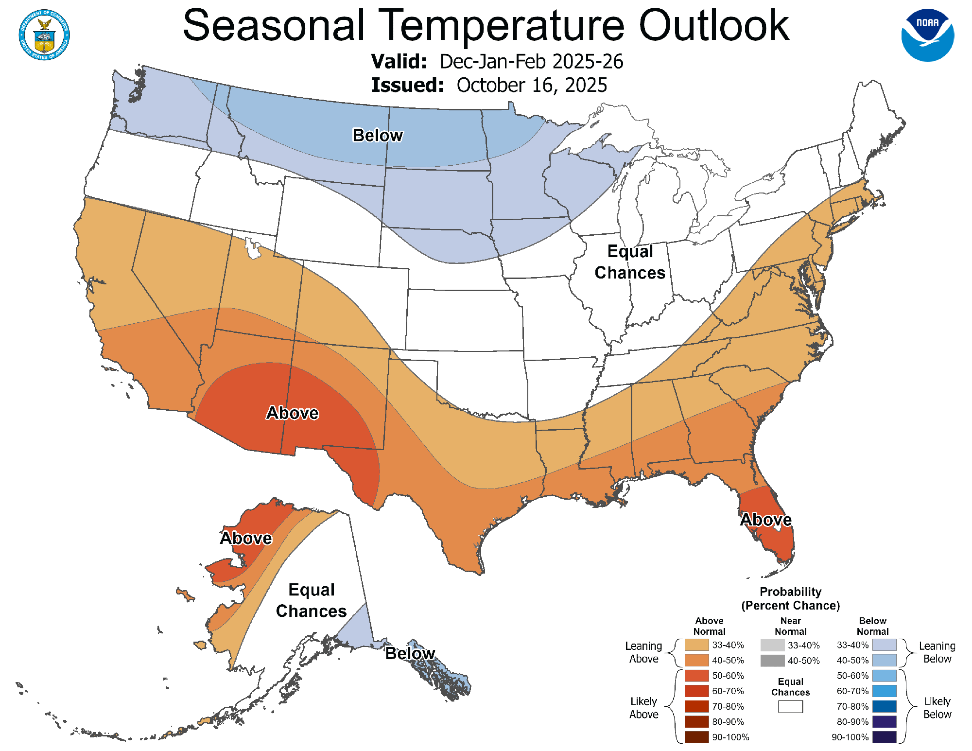 The December-February outlook from NOAA shows below normal temperatures in the Upper Midwest, northern Rockies and Pacific Northwest.(National Weather Service Climate Prediction Center)
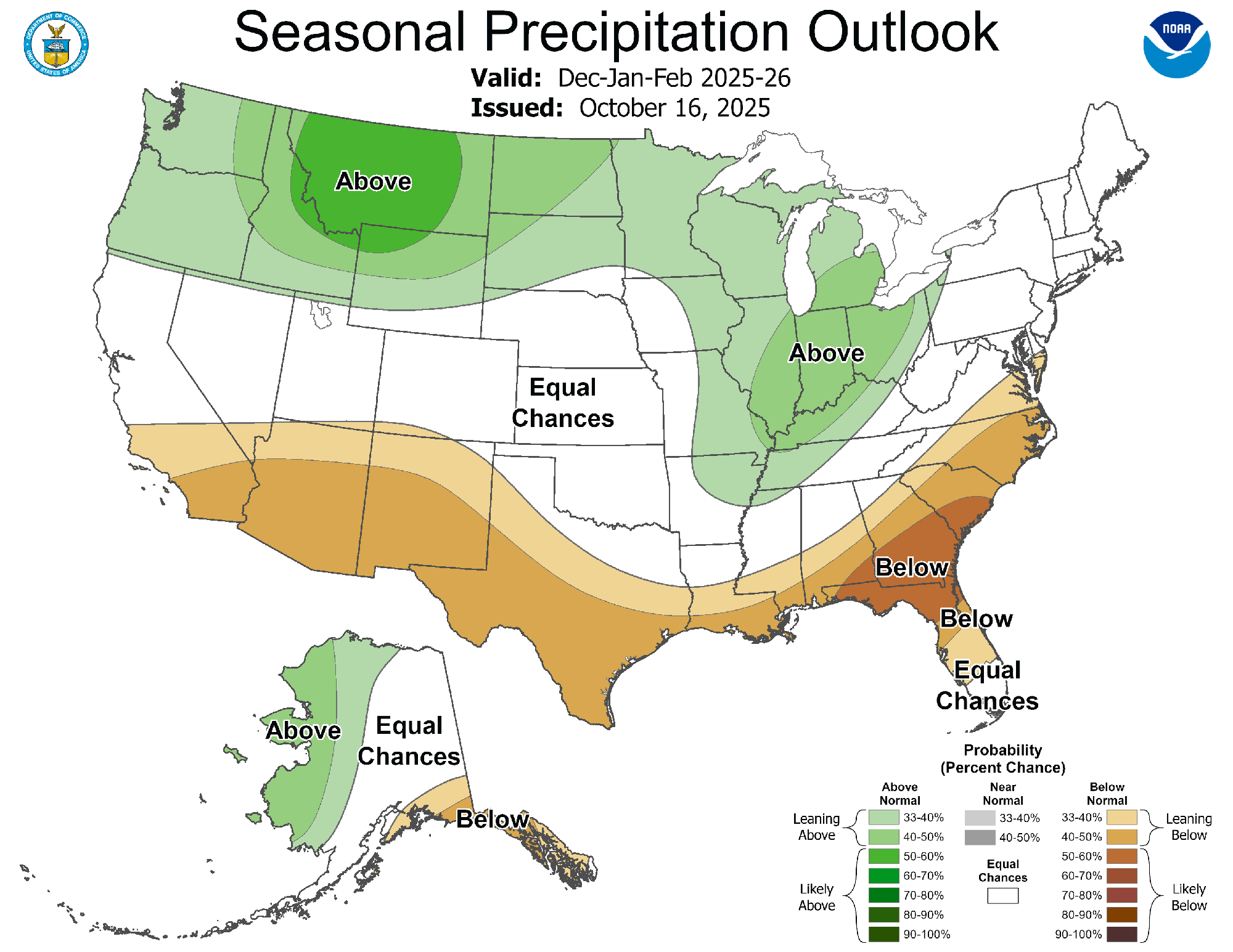 The December-February outlook from NOAA shows above normal precipitation chances in the Upper Midwest, Great Lakes, Ohio Valley, northern Rockies and Pacific Northwest.(National Weather Service Climate Prediction Center)


