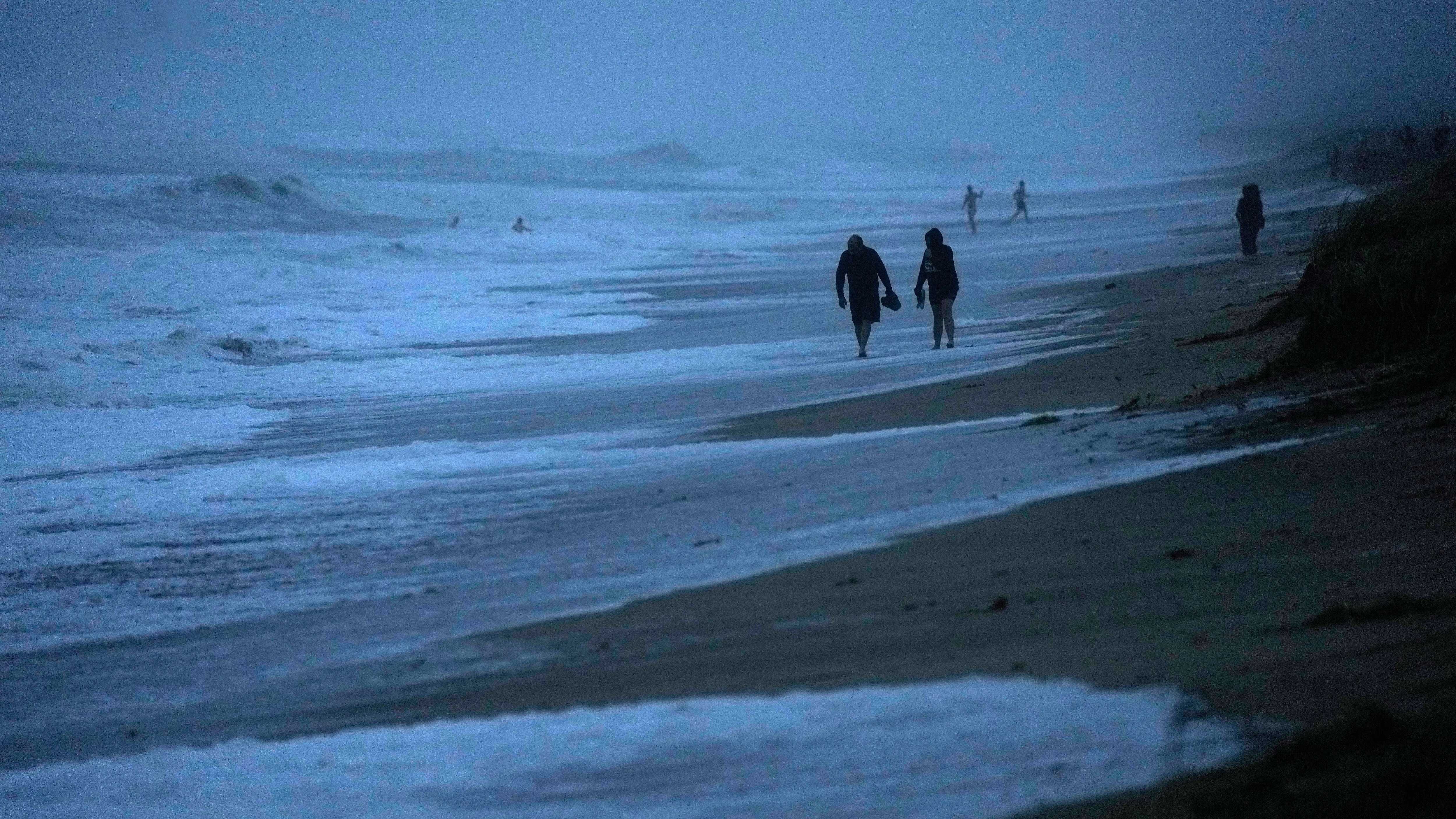
Remember severe thunderstorm warnings? Tornado warnings? A storm watch? Just a regular, run-of-the-mill thunderstorm with heavy rain?
If you are scratching your head and wondering where those have been this spring, you’re far from alone. The state’s meteorologists and climatologists are wondering the same thing.
DJ Kayser, a meteorologist with Praedictix in Eden Prairie, reports only 38 severe storm warnings so far in the entire state. Last year we saw 350 warnings. Four tornado warnings across Minnesota so far and there were 79 last year as of June 7.
These aren't necessarily unprecedented numbers. Minnesota has had many years with little to no severe weather activity. But that combined with the lack of much rain at all, and the early season heat, means we sort of skipped over spring entirely.
You can blame the early arrival of higher than normal temperatures this summer for a lack of thunderstorms. And while nobody wants the destructive force of a tornado, the high amounts of precipitation that come from these spring and early summer convective storms is hurting Minnesota.
Minnesota Senior Climatologist Kenny Blumenfeld says a lack of low pressure systems across the Upper Midwest means no tornados and not much rain on the horizon.
“When the really warm still air moves in, usually it's more in the middle of summer,” explains Blumenfeld. “That's when the severe weather season kind of either slows down or shuts off completely. This year, we seem to get that arriving six to eight weeks ahead of schedule.”
That has meant very little rain from the end of winter into the start of the dog days of summer, and that’s not good.
Blumenfeld says if weather systems don't change, it could mean higher risks of drought. The same dry summer conditions Minnesota saw the last couple of years.
“All of Minnesota is highly dependent on thunderstorms,” Blumenfeld says. “While we don't like tornadoes, nobody likes wind damage or hail damage, they also produce about 50% of our annual precipitation.”
Much of Minnesota is now listed as abnormally dry, and in their weekly release from the U.S. Drought Monitor on Thursday, parts of the state are now in moderate drought for the first time this year.
That winter snow pack only lasted so long. We went quickly from flash flooding in April to drought in June.
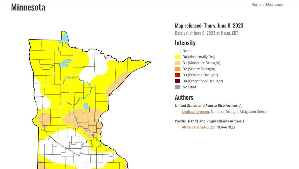 The U.S. Drought Monitor now lists portions of Minnesota, including part of the Twin Cities, in a moderate drought for the first time in 2023. A large portion of the state remains abnormally dry.(U.S. Drought Monitor / NOAA)
Current forecasts from the National Weather Service predicts a continuation of higher than normal temperatures through the end of June with no major storms bubbling up.
WCCO Chief Meteorologist Paul Douglas says the weather might be perfect for outdoor activities, but we still need rain.
“We’re in this holding pattern, weather patterns have stalled, and it’s just wacky out there,” says Douglas. “I don’t see any significant rain look out the next week to 10 days. The more I look at this, the more I think this summer the focus is going to be on heat, expanding drought, and smoke.”
That is the other side effect of our strange weather. Minnesota has seen air quality issues and it was certainly big news Wednesday with almost unprecedented air quality concerns on the East Coast, especially New York. The Yankees-White Sox game was postponed due to smoke in the air and even inside the Barclay’s Center in Brooklyn the air was bad enough that the Lynx game against the New York Liberty was scrapped.
Mars had nothing on New York Wednesday with a murky, red, smoky haze over the entire city.
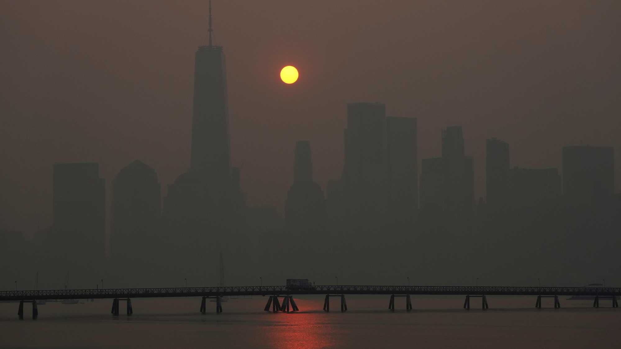
That is because Canada is unseasonably hot and dry like Minnesota. The difference is the wildfires in Canada are burning out of control and weather patterns have continued to fuel those fire (and the smoke heads south).
The break Minnesota had from the smoke yesterday is also coming to a quick end. Douglas says we will not have it as bad as those on the East Coast, but it may be unhealthy again for those in high risk categories concerning lungs and hearts. So far, no air quality alerts have been posted.
And now as we head into the real heat of summer, there are predictions of an El Nino which has formed earlier than usual. An early arrival means more time to grow, which means warming up an already warm planet.
“The onset of El Nino has implications for placing 2023 in the running for warmest year on record when combined with climate-warming background,” said University of Georgia meteorology professor Marshall Shepherd.