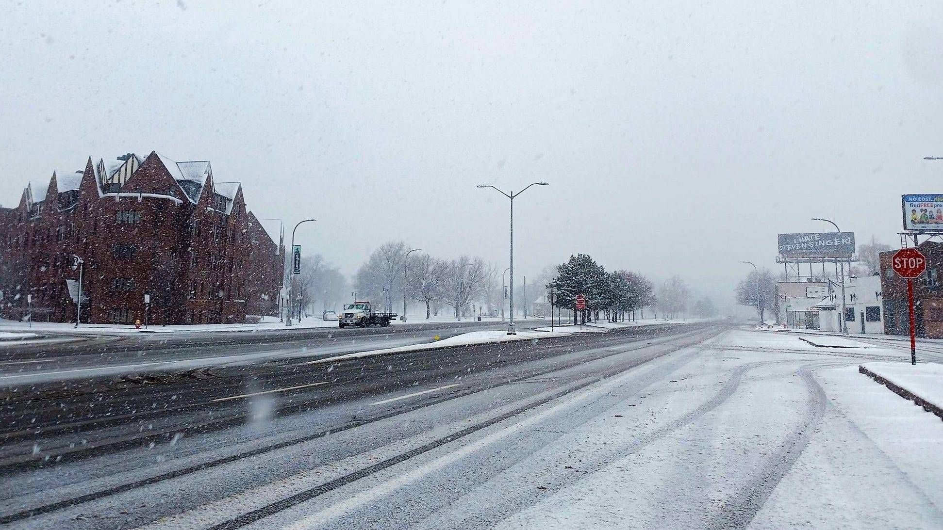
METRO DETROIT (WWJ) - Metro Detroiters are waking up to accumulating snowfall earlier than expected on Wednesday, causing a slew of school closings, traffic crashes and treacherous travel — and more snow is on the way.
Ten counties in the area — including Shiawassee, Genesee, Lapeer, Livingston, Oakland, Macomb, Washtenaw, Huron, Sanilac and St. Clair Counties —are under a winter storm warning and a winter weather advisory through the late evening hours as snow began falling quickly well before sunrise.
According to the National Weather Service, a narrow band of snow lifted into southern Michigan around 4 a.m., kickstarting a long, snowy day ahead.
Late in the morning, NWS issued a Special Weather Statement for Oakland, Wayne and parts of Macomb County, warning of bands with high intensity of snowfall moving through the area.
Experts said snowfall rates will reach an inch an hour at times, resulting in another two inches through 2 p.m. with some areas potentially seeing higher amounts.
Visibility could potentially be reduced to a half a mile or less in these conditions, meteorologists said.
"We're in for the snow today," WWJ AccuWeather Meteorologist Dean DeVore told WWJ's Jackie Paige. "A winter survival day with winter storm warnings out through early this evening -- some steady snow all day and some heavy snow looks like this afternoon into this evening."
DeVore warned of treacherous travel expected on roadways especially later in the day and into the night where another round of snow is forecasted.
The NWS predicted the peak of the heaviest snowfall rates between 10 a.m. and 4 p.m.
Early in the afternoon, WWJ's Ryan Marshall reported the roads in Macomb County were "starting to deteriorate at a very rapid pace" — both the highways and some side streets. "The snow is starting to come down heavy now as we reach into the afternoon," he said.
 Snowy roads in Macomb County, Wednesday afternoon.Ryan Marshall/WWJ
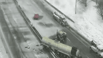
WWJ's Charlie Langton said it didn't take long for spin outs to occur around Metro Detroit, including one on the EB I-94 entrance ramp in Clinton Township.
"Clinton Township Fire on the scene and there's an MDOT courtesy patrol, they're on the scene as well, probably very busy today with all of the crashes around Metro Detroit," Langton reported live from the scene. "This is just a typical one, probably a spin out, don't know how serious it is, but obviously you've got to take it slow."
Michigan State Police also put out a warning to drivers as crashes and traffic incidents continued to mount, although they said the number of crashes aren't high in number — yet.
"This is just the beginning of what we're expecting throughout the district," Lt. Mike Shaw said on social media. "... the crashes we're seeing — people hate it when I say this — are self-induced. What weather does, it doesn't cause any type of crashes, you can't say 'oh I got into a crash because it was snowing,' No, you got into a crash because you were going to fast. You got into a crash because you were following too closely. You got into a crash because you were driving distracted."
Shaw said drivers can avoid dangerous collisions by leaving for their destination early, slowing down and taking extra time.
"Bad driving behavior, that's what gets you into trouble," Shaw warned.
MSP said the roads aren't overly crowded with commuters, most likely due to the amount of school closures announced ahead of the storm. Multiple districts across the region cancelled classes Wednesday with alerts, emails and messages to students and parents.
Residents can stay up to date on school closures by contacting their district officials for the latest information.
Snow plow drivers, on the other hand, expressed excitement to WWJ's Mike Campbell ahead of a long day of work after snow remained elusive in Southeast Michigan going into the start of the new year.
"You know, we're gonna do a couple hours salt and then maybe eight hours plow and then couple hours salting again later, we're gonna wait till it stops," a contractor in Southfield told Campbell earlier Wednesday morning as the snow began to fall. "Probably at least 10 hours or so if it keeps going."
"I'll be out all day. I'll be salting all day long and plowing," another contractor said to Campbell. "And when I get done doing all my commercial accounts, we'll be hitting residentials."
The NWS warned that the onset of heavier snow is due to hit the Southeast Michigan after the morning commute where six to eight inches are expected. Experts said the biggest impacts to travel will come late morning into the afternoon hours as conditions continue to deteriorate.
For the latest updates on the winter storm affecting Metro Detroit, tune into WWJ LIVE for traffic and weather together every 10 minutes on the 8s.