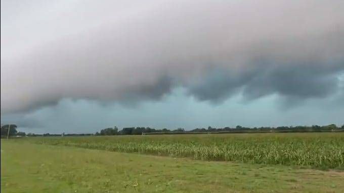
DETROIT (WWJ) - Metro Detroiters still dealing with the aftermath of Wednesday's storms now have another bout of bad weather to deal with as they head into the weekend.
AccuWeather meteorologists warn that additional rounds of dangerous, disruptive and damaging thunderstorms are expected to erupt on Friday, from southern South Dakota and central Nebraska to the Lower Peninsula of Michigan.
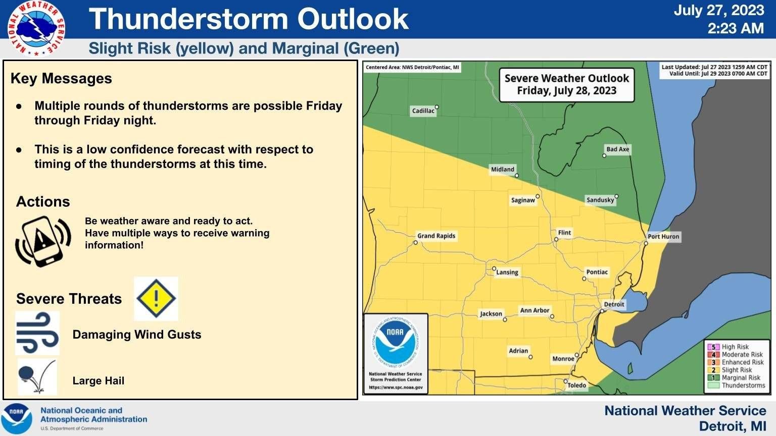
The National Weather Service has issued a Flood Watch from now until 6 a.m. Saturday, July 29, for the entire Metro Detroit area and points to the south including Lenawee, Livingston, Macomb, Monroe, Oakland, St. Clair, Washtenaw and Wayne Counties.
The watch comes as a moist airmass, along with a build up instability on Friday, is forecasted to organize into numerous showers and thunderstorms. AccuWeather said the line, or possible lines, of storms will likely become severe and push through portions of the Interstate 80, 90 and 94 corridors.
The storms are expected to impact the area from late afternoon through the night. The biggest threats at this time sound like a broken record for Michiganders — the storms are forecasted to bring damaging winds that could get up to 80 mph, large hail and of course, flooding.
"Rainfall totals around 1 inch can be expected for most areas, but the potential exists for localized totals of 3 inches or more if the training of thunderstorms occurs," the NWS forecasted.
Experts warned that excessive rainfall rates have a high probability of causing flooding in poor drainage and urban areas. Low-water crossings may be flooded.
AccuWeather said travel disruptions at Detroit Metro Airport are "likely and flight delays will mount."
Friday's storms are striking the same corridor that a long-lasting complex of severe thunderstorms -- with wind gusts exceeding 58 mph -- packed a punch just two days before.
The NWS is currently investigating if the storm that moved along a 300-mile swath from near the southeastern shore of Lake Michigan to the southern shore of Lake Erie could be classified as a derecho.
According to weather experts, a storm is classified as a derecho if wind damage swath extends more than 240 miles and has wind gusts of at least 58 mph or greater along most of the length of the storm's path.
For more on how to prepare for flooding potential, visit MI READY at Michigan.gov.
This is a developing story. Stay tuned to WWJ LIFE for full storm coverage plus Traffic & Weather together every ten minutes on the "8s"