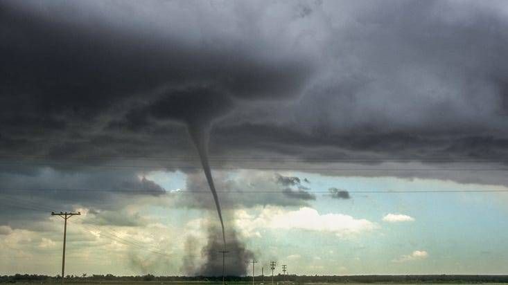
(WWJ) There was another chance for severe weather in Southeast Michigan last night — including an isolated tornado or two — when another storm system headed toward the region.
WWJ AccuWeather Meteorologist Brian Thompson said these thunderstorms could have brought damaging winds, hail and heavy downpours to the metro Detroit area overnight on Wednesday, and into the morning.
A Flash Flood Watch was in effect late Wednesday for Macomb, Oakland, Wayne, Lenawee, Livingston, Monroe and Washtenaw Counties, but ended just before 9:00 a.m. on Thursday.
As of this morning, AccuWeather Meteorologist Dean Devore says that showers and thunderstorms were once again surfacing in metro Detroit, particularly along I-75 near Macomb Township.
This comes after strong storms spun up four tornadoes in Michigan last Saturday — including in Macomb County's Armada and Oakland County's White Lake, where extensive damage was reported.
In anticipation of the severe weather last night, the Great Lakes Water Authority said it had "staffed accordingly," including at the Conners Creek and Freud Pumps Stations, where there were issues last month.
WWJ has an eye on the sky. Stay tuned to AM 950 for the latest forecast, every 10 minutes on the 8s. >>LISTEN LIVE