SOUTHFIELD (WWJ) -- After heavy rain and some strong thunderstorms moved through Southeast Michigan already Wednesday, forecasters are warning that there's more yet to come.
A Severe Thunderstorm Watch was issued for all of Southeast Michigan until 10 p.m. Wednesday, with the NWS warning that a second round was expected to hit Metro Detroit between the hours of 6 p.m. and 10 p.m.
During the first round, a Tornado Warning issued for Southwestern Macomb County — including Warren, Sterling Heights and Fraser — was canceled shortly before 1:30 p.m.
There was some damage reported in the area of 14 Mile Rd. and Garfield, and also Kelly Road between 14 and 15 Mile. The National Weather Service said "radar indicated rotation" in this area, where it's investigating a "probable tornado."
The worst hit areas include Fraser, Clinton Township and Macomb Twp., where there's been some major flooding.
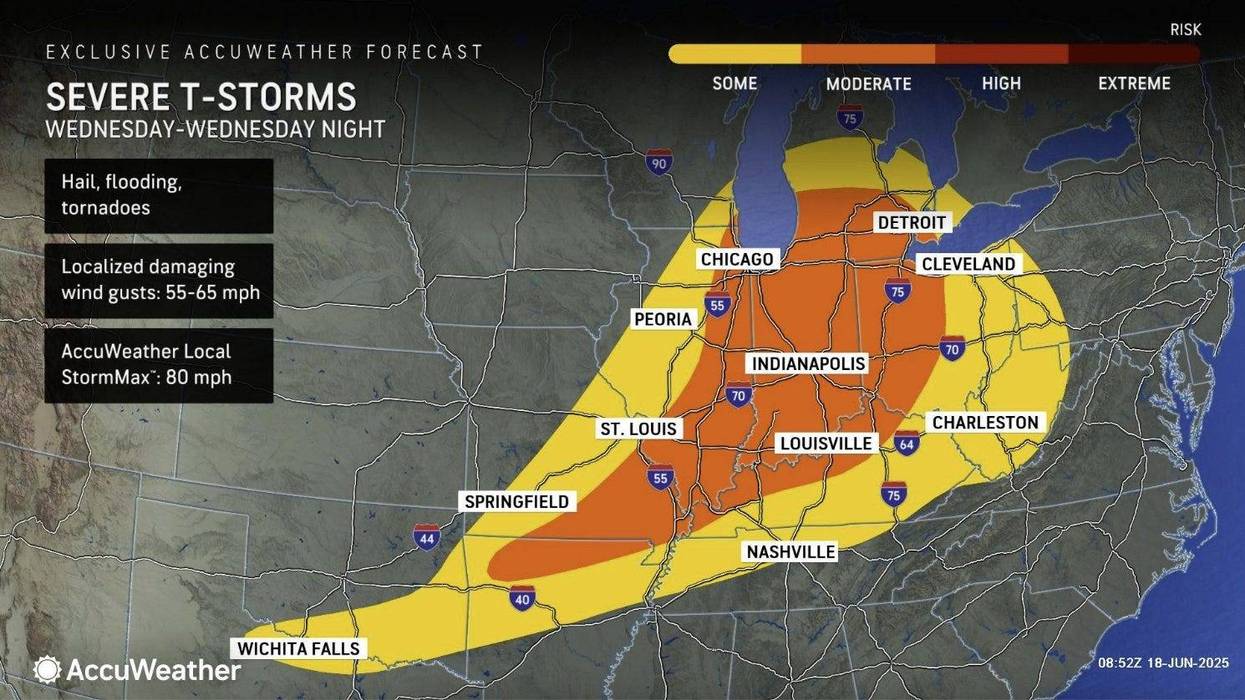
AccuWeather Meteorologist Heather Zehr said severe weather threats into the night include flooding downpours, strong winds and hail possible.
Localized wind gusts could do some damage, reaching speeds of up to 55-65 mph, according to AccuWeather.
By afternoon, pockets around Metro Detroit were dealing with power outages. At 3 p.m., DTE Energy was reporting about 7,000 homes and businesses affected. [CHECK THE OUTAGE MAP]
Zehr said tornadoes were a slight concern.
"That is going to be, I think, a very isolated incident, but it is something that is potentially in the cards for today," Zehr said, speaking live on WWJ Newsradio 950. "So, definitely something you're gonna want to keep an ear out for as you go through your day, and even into the nighttime hours that risk is still going to be there."
 Power line damage in Fraser.Tim Pamplin/WWJ
Zehr said the high temperature in the Detroit area will get up to 85 degrees on Wednesday, dropping to around 67 overnight.
Heavy rainfall remains possible through Thursday morning as several rounds of showers and thunderstorms impact the region. Average rainfall totals over the course of Wednesday will be 0.75-1.50 inches with locally higher totals (1.5-3 ") likely, according to the National Weather Service.
Zehr said after the rain moves out on Thursday, it'll be windy and not as warm and not as humid the the rest of the day. Clouds may break for a little sunshine, however, as temps top out at around 78.
Friday is looking partly sunny and quite warm with a high of 86, "a pretty nice day," Zehr said.
Saturday and Sunday are looking dry, with sun and some clouds — but it's going to be getting hotter.
AccuWeather is calling for a high of 92 degrees on Saturday and 96 on Sunday.
Don't miss an update! Stay with WWJ Newsradio 950 for the latest on the weather, along with traffic, every 10 minutes on the 8s. To stream us live anywhere, download the free Audacy app and follow WWJ. >>LISTEN LIVE!!