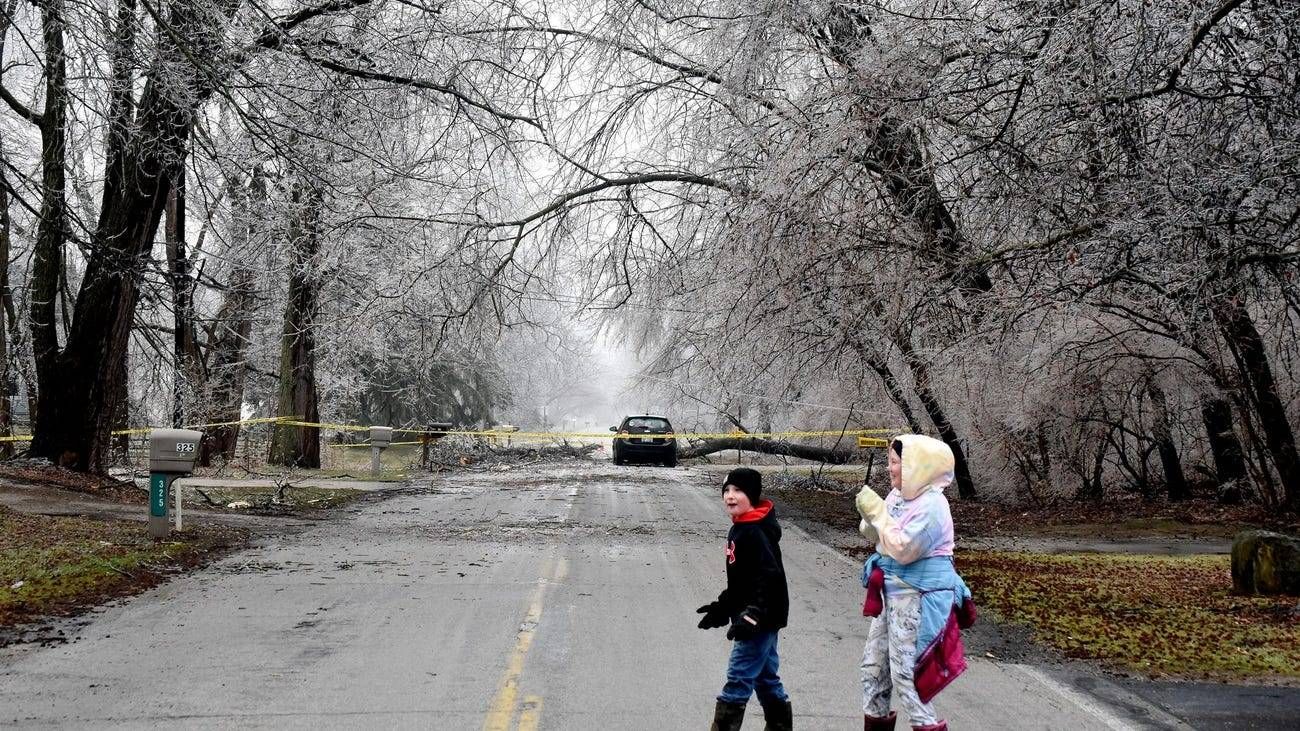
(WWJ) Dreaming of an early spring? If you're more than a little aggravated by the wet, slick and snowy mess in Metro Detroit lately, you can blame it — at least in part — on La Niña.
"For our area specifically, we've had slightly above average for the number of winter storm events that we would normally see," said Meteorologist Rich Pollman, with the National Weather Service in Detroit.
"Every winter is going to be different," he said, "but it is not unusual for a winter that is under the La Niña pattern, where you get more of your winter storms in the second half of the winter, rather than the first half of the winter. And we've actually seen this over the last two winter when we've had La Niña now for three winters in a row."
"February of 2021, February of 2021 were very active, while were quiet leading into those Februaries. This year, we had one winter storm around Christmas, one winter storm on January 25th, and then it has gotten very active here the last two weeks of February and the first two weeks of March."
Speaking to WWJ's Zach Clark for an episode of The Daily J podcast, Pollman said, unfortunately, this wet and wild weather pattern has just been hovering over Metro Detroit.
"Our weather patterns generally take three to six weeks before they change, so you can get into a pattern where you have the same basic type of setup, and Metro Detroit over the last could of weeks has been right on that rain/snow line." Pollman said. "And this weather pattern has set up over Metro Detroit before when we've had a winter characterized by the rain/snow/sleet/freezing rain mixture line being over Metro Detroit."
Pollman said this winter, unfortunately, the storms just happen to have moved over the Great Lakes at the perfect time to create that unpleasant wintry mix.
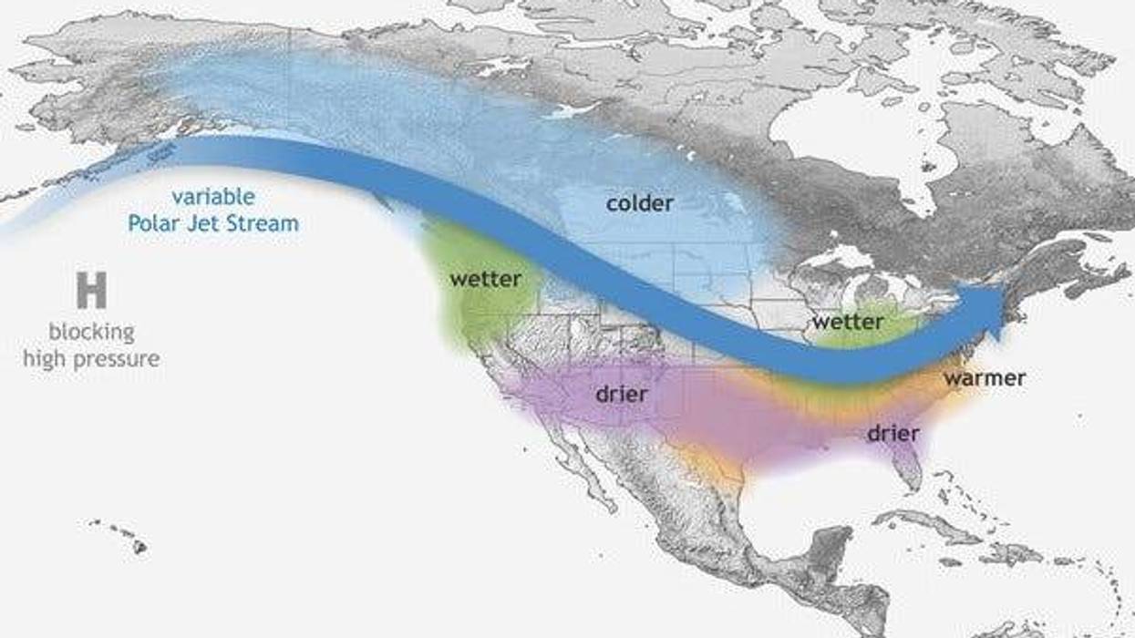
What is La Niña?
La Niña is the cold phase of a fluctuating climate pattern known as the El Niño Southern Oscillation — something that happens when strong trade winds blow warm surface water away from South America, across the Pacific Ocean towards Indonesia. According to Climate.gov, the pattern shifts back and forth irregularly every two to seven years, bringing predictable shifts in ocean surface temperature and disrupting the wind and rainfall patterns across the tropics. These changes have a cascade of global side effects, including bringing wetter winter weather to Lower Michigan.
What about climate change?
Scientists say climate change is a major factor in worsening extreme weather, alongside La Niña, according to numerous studies and reports. Human-caused warming is like an escalator going up: It makes temperatures increase and extremes worse, while La Nina and El Nino are like jumping up and down on the escalator, according to Northern Illinois University atmospheric sciences professor Victor Gensini. (More on the effects of climate change in The Daily J).
What's coming next? Looking ahead, NOAA forecast say there's a 60% chance that La Niña's warmer cousin El Niño will take charge come fall, and there's a 5% chance that La Nina will return for an unprecedented fourth dip next season.
In the nearer term, winter isn't over with us quite yet. WWJ AccuWeather Meteorologist Dean DeVore said there's a chance for a little more snow in Metro Detroit all day Monday into Monday evening, with a coating to an inch in most areas, and heavier squalls possible in places. But the rest of the week, and into next week, so far look ice and snow-free.
Stay with WWJ Newsradio 950 for traffic and weather updates, every 10 minute on the 8s. At home, tell Alexa to "Play WWJ nine-fifty."
More on today's top stories: