DETROIT (WWJ) - The work week is starting off brisk and relatively quiet weather-wise in the Midwest, but meteorologists are keeping their eye on the forecast as an impactful weekend storm could bring strong winds and hazardous wintry conditions into Michigan.
AccuWeather experts said conditions are so far on track to support a sudden change in the weather pattern, which would help fuel a highly disruptive storm and impact residents from the Midwest to the Gulf Coast over to the East Coast.
Most of Michigan is forecasted to see surging winds of 40 to 50 mph or greater along with significant rainfall for this time of year -- and, depending on when the cold air moves in, possibly heavy snowfall in some U.P. and western communities.
 AccuWeather
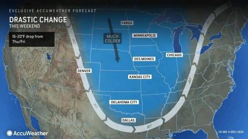
"During the day on Friday, a storm tracking through the central Rockies will shift into the southern and central Plains, developing a new area of low pressure," AccuWeather meteorologists explained. "Chilly air blowing out of the Rockies and northern Plains will clash with warm and humid air flowing out of the Gulf of Mexico, which can spawn a rapidly intensifying storm.
The storm is forecasted to grow in strength on Saturday, bringing severe storms and rain to the South -- before its effects begin marching into the Great Lakes region overnight.
"This storm will interact with cold air on the northwest side of the storm," AccuWeather Meteorologist Joe Bauer said. "If the cold air can move in quickly enough, we could be looking at a zone of impactful snow from the Midwest and up through the Great Lakes Saturday into Sunday."
For the Metro Detroit area, we will likely see more pouring rain than snow, but even the slightest shift in the storm track could mean the difference between a dreary December deluge or snowfall.
Either way, meteorologists said residents in the Great Lakes region are going to want to stay up to date with the latest forecast and be prepared for hazardous wintry conditions over the weekend.
 AccuWeather
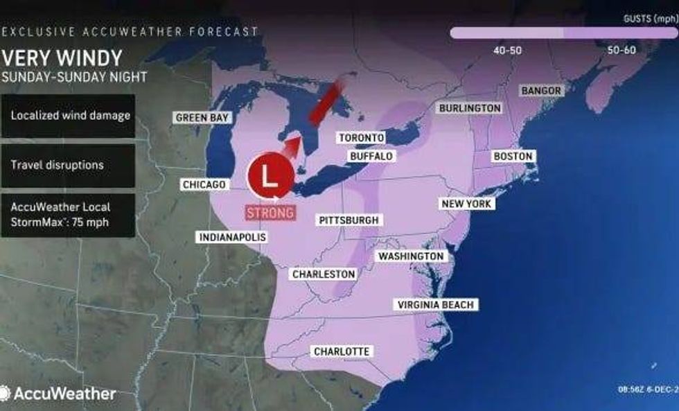
On top of rain and snow, the winds are forecasted to pick up all across Michigan on Sunday into Sunday night. The highest gusts are expected to top out at 50 mph.
The wind can cause travel disruptions and localized wind damage, meteorologists said.
The change from rain to snow could occur in Metro Detroit Sunday into Sunday night, but the forecast remains uncertain if it will lead to any measurable amounts.
Stay tuned to the latest changes in the forecast by listening to WWJ LIVE with Traffic and Weather together on the :08s