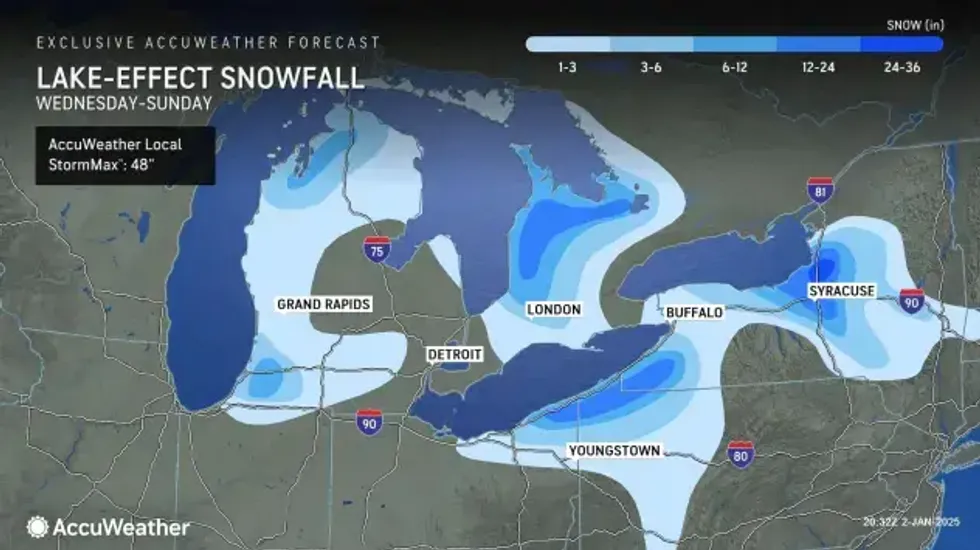
(WWJ) The lake effect snow machine is cranking up, just in time for the weekend. Forecasters say parts of Northern Michigan could see more than a foot of accumulation over the new few days.
Andy Sullivan, with the National Weather Service in Gaylord, said most of the snow will be in the Upper Peninsula, but Northern Lower Michigan will get some, too.
"We've had just some very, like historically large lake effect snow events here at the office," he said, in an interview with WWJ Newsradio 950's Ryan Wrecker. "We've been targeted; just the flow of Lake Superior, Lake Michigan has been right into Gaylord — especially at the office. We're about nine miles south of Gaylord, but we had two separate events that were like 20 to 30 inches over a 24-hour period."
 AccuWeather
Sullivan said some of these northern parts of the state are on track for record snowfall this winter.
"The most we've ever recorded is 185 inches, and that was in 2006/7 winter," Sullivan said. "So, there are some not official reports of over 200 inches in the Gaylord area. But anything approaching 180 to 200...you're looking at, you know, a lot of snow, with records being broken most cases."
The lake effect snow is expected to taper off Saturday morning, but additional rounds are possible Sunday night into Monday morning. Then another system bringing colder temperatures and more lake effect snow will come into the area Tuesday night and into Wednesday, according to the NWS.
Meanwhile, in Southeast Michigan, forecasters are calling for lighter snow accumulations. Although AccuWeather Meteorologist Joe Lundberg said driving conditions on Friday could get dicey.
"This will become more snow showery in nature, if you will, this (Friday) afternoon. And by that I mean reduced visibility for brief periods of time," Lundberg said. "But that can produce a quick little film of snow in places, so be prepared for that."
Because it's been so cold, Lundberg said drivers should expect some icy spots on roads and freeways.
Lundberg said the snow will clear up in Metro Detroit Friday night, and it'll be mostly dry, and just very cold over the weekend.
On Saturday, the high in Detroit will reach only 26 degrees, Lundberg said, and around 29 degrees on Sunday.
The next snow in Metro Detroit will likely come Sunday night into Monday morning, effecting roads conditions during the Monday morning commute.