DETROIT (WWJ) - The season's first significant winter storm is forecasted to unleash snow, ice and rain on millions of Americans this weekend -- and weather experts warn Metro Detroit could be in its crosshairs.
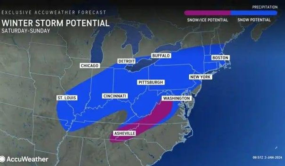
AccuWeather meteorologists say it's not only this winter's first major storm, but it also might be the largest seen in nearly two years in some areas as forecasting models show widespread precipitation across the lower Great Lakes region, the mid-Atlantic and New England.
"The storm is expected to blossom across the Southern states to start the weekend, likely bringing along a swath of heavy rain and thunderstorms," AccuWeather Meteorologist Brandon Buckingham said, adding, "At the same time, farther to the north over the Ohio Valley, the storm can expand northward into cold enough air for snow to fall."
So far, forecasters say models are showing a high probability for snow to "expand rapidly" once the storm's moisture hits the center and southern Appalachians and parts of mid-Atlantic and southern New England late Saturday.
The storm will eventually collide with an area of cold air held in place over the Great Lakes and Northeast, allowing a snow-event to unfold.
 AccuWeather
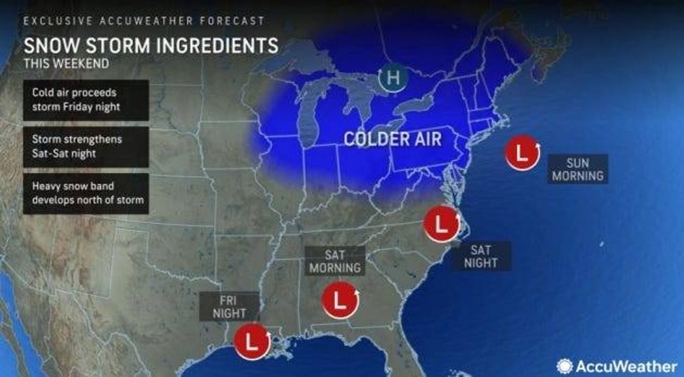
The amount of snow and where exactly it will fall is still hard to pinpoint as those factors depend on the storm's strength and its tack. Right now, meteorologists say the system could stay more to the south, meaning Detroit could just narrowly miss on all the action.
But if it curves north -- it could be a different story.
"We got to work it out depending on what happens with this storm that's crossing the country and goes up into the northeast this week and we could get a piece of that," DeVore warned of the forecast from Saturday night into Sunday. "Right now, we're looking at an inch or two possibility, but we'll keep an eye on that."
AccuWeather currently has Detroit sitting at the northern-most tip of the potential impact zone -- but it appears to be a bullseye for areas around the I-95 corridor from Washington, D.C., to Philadelphia, New York City and Boston.
"The most significant wintry effects from the storm will be limited to about 12-18 hours or so from late Saturday into Sunday evening," Travis said, adding the storm is not expected to stall and will keeping moving.
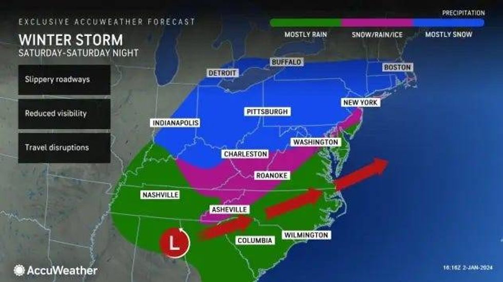
The storm could bring about the end to a snow drought that has gripped many northern cities this season with dismal snow totals recorded across the central Appalachians, Great Lakes region and coastal New England.
 AccuWeather
 AccuWeather
Many locations have received less than a third of their historical average snowfall, AccuWeather said, with some areas under 10% of the average.
The National Weather Service in Detroit said December 2023 only saw 0.1" of snow in the area, equaling the second least snowy December on record, tied with 2014.
The average temperature was 40.1°F, making it the third warmest December on record.
"Snowfall totals vary widely across SE MI, a trend observed across our other climate sites," the NWS continued. "Despite this, Flint and Saginaw both made the top 10 list for least snowy Decembers. Flint recorded its 5th least snowy December with 1.8", and Saginaw its 7th with 2.1."
"Additionally, both cities experienced their second warmest Decembers on record, with Flint averaging 39.2°F and Saginaw at 38.0°F."
This is a developing story. Stay current on the latest weather updates and forecast by listening to WWJ LIVE.