SOUTHFIELD (WWJ) -- A Winter Weather Advisory is now in effect for Oakland, Macomb, Wayne, Washtenaw, St. Clair and Livingston counties, with 1 to 3 inches of fast-falling snow that could make travel tricky on Tuesday.
The National Weather Service says snow showers starting in the morning will increase into the early afternoon, before tapering off into flurries. The Winter Weather Advisory is set to expire at 2 p.m.
Drivers in Metro Detroit are advised to plan for slippery road conditions and rapidly changing visibilities. The NWS says intervals of higher intensity snow showers may cause brief periods of near white out conditions — so caution on the roads and freeways is advised.
In Wayne and Washtenaw counties, forecasters are calling for 1-3 inches of snow accumulation by the time it's all over.
In Macomb, Oakland Livingston and St. Clair Counties, NWS is calling for a little more: 2 to 3 inches of accumulation, with locally higher amounts possible.
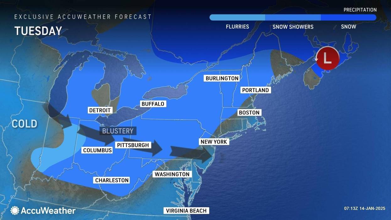
Meanwhile, AccuWeather says it's going to be quite cold out there.
"The bigger story, I think, over the next couple of days is going to be the cold," said AccuWeather Meteorologist Brian Thompson.
On Tuesday, Thompson said the high in Metro Detroit will only get to around 20 degrees, with the windy conditions making it feel more like a frigid -1°.
And if Up North, take note: AccuWeather some of the highest snow totals through midweek, which could exceed a foot, are expected across the Keweenaw Peninsula, the Porcupine Mountains and between Munising, Michigan, and Whitefish Point, Michigan, along the shores of Lake Superior.
"A storm currently sweeping through the Great Lakes region bringing a round of snow will also kick off another round of lake-effect snow downwind of the lakes over the upcoming days. Once again, the potential for feet of snow downwind of Lakes Huron, Erie and Ontario are possible between Monday and Wednesday night, likely leading to hazardous travel," said AccuWeather Meteorologist Brandon Buckingham.
Looking ahead into the week: Metro Detroit could see a little more snow on Wednesday night and Thursday, accumulating a fresh coating to an inch.
It may warm up a little more on Thursday in the weekend, with high temperatures reaching into the mid-30s — but enjoy it while you can.
Forecasters say the coldest airmass of the winter season expected to arrive next Monday, Jan. 20.
Get the detailed daily AccuWeather forecast HERE.
Don't get caught out in it! Stay with WWJ Newsradio 950 for weather updates, along with traffic, every 10 minutes on the 8s. Tell your smart speaker "Play WWJ nine-fifty" or stream us live on the FREE Audacy app. >>LISTEN NOW