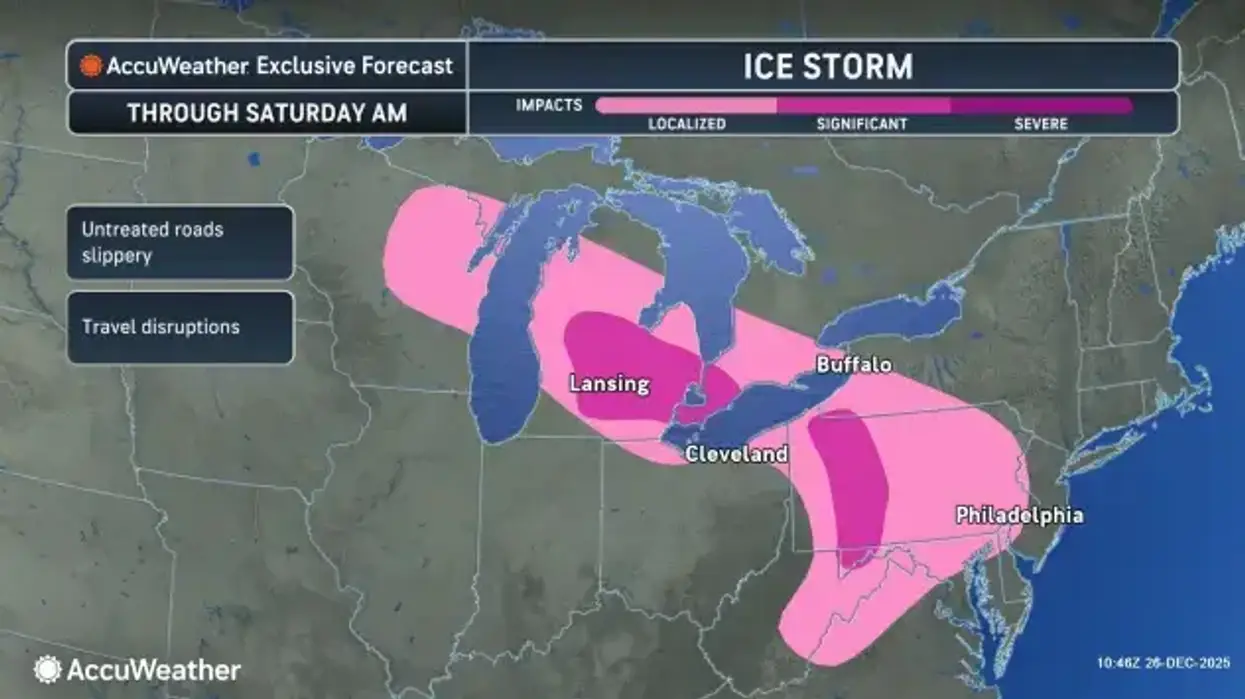
(WWJ) A Winter Weather Advisory is in effect for Southeast Michigan until 4 p.m. Friday.
Freezing rain is expected and total ice accumulations will range between one tenth of an inch to just below a quarter inch, according to the National Weather Service.
An alert put out to residents in Metro Detroit early Friday said the higher end ice accumulation potential to or above two-tenths of an inch will be favored around the M-59 corridor through the I-69 corridor, and north through Saginaw, Tuscola, and Sanilac Counties.
In addition to freezing rain, some mixing of sleet remains possible across the northern Tri-Cities and northern Thumb, with sleet accumulation potential to a half-inch or less. Locations towards Metro Detroit and the Ohio border have the best chance of temperatures rising above freezing by the afternoon.
Early Friday morning, the Michigan Department of Transportation closed the Zilwaukee Bridge in both directions due to crashes and icy conditions. Saginaw County 911 Central Dispatch said accidents are starting to come in for I-675 due to icy road conditions. Please avoid highway travelling if possible and seek alternate routes. If the highway must be taken, please slow speeds and use extreme caution.
Tune in WWJ Newsradio 950, AM 950, for the latest.