


The National Hurricane Center says Hurricane Hunters have found a center of circulation around a tropical low in the Gulf of Mexico, and they have now named they system Tropical Storm Barry.
"Reports from Air Force Reserve and NOAA Hurricane Hunter aircraft indicate that maximum sustained winds have increased to near 40 mph with higher gusts," according to the advisory from the Hurricane Center.
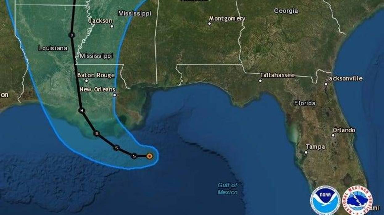
They say it is expected to get stronger.
"Additional strengthening is expected during the next day or two, and Barry could become a hurricane late Friday or early Saturday."
Landfall is predicted for Saturday morning near Morgan City, Louisiana.
RAINFALL: Barry is expected to produce total rain accumulations of 10 to 15 inches near and inland of the central Gulf Coast through early next week, with isolated maximum rainfall amounts of 20 inches across portions of eastern Louisiana and southern Mississippi.
STORM SURGE: The combination of a dangerous storm surge and the tide will cause normally dry areas near the coast to be flooded by rising waters moving inland from the shoreline. The water could reach the following heights above ground somewhere in the indicated areas if the peak surge occurs at the time of high tide...
- Mouth of the Atchafalaya River to Shell Beach...3 to 6 ft
- Shell Beach to the Mississippi/Alabama border...2 to 4 ft
- Intracoastal City to the Mouth of the Atchafalaya River...2 to 4 ft
- Lake Pontchartrain...1 to 3 ft
WIND: Tropical storm conditions are expected in the Tropical Storm Warning area by Friday. Hurricane conditions are possible within the Hurricane Watch area by Friday night, with tropical storm conditions possible in the Tropical Storm Watch area by Friday night or Saturday.
A Tropical Storm Warning is in effect for...* Mouth of the Pearl River to Morgan City
A Storm Surge Warning is in effect for...* Mouth of the Atchafalaya River to Shell Beach
A Storm Surge Watch is in effect for...* Shell Beach to the Mississippi/Alabama border* Mouth of the Atchafalaya River to Intracoastal City
A Hurricane Watch is in effect for...* Mouth of the Mississippi River to Cameron
A Tropical Storm Watch is in effect for...* East of the Mouth of the Pearl River to the Mississippi/Alabamaborder* Lake Pontchartrain and Lake Maurepas including metropolitan NewOrleans
A Tropical Storm Warning means that tropical storm conditions are expected somewhere within the warning area within 36 hours.
A Storm Surge Warning means there is a danger of life-threatening inundation from rising water moving inland from the coastline during the next 36 hours in the indicated locations. For a depiction of areas at risk please see the National Weather Service Storm Surge Watch/Warning Graphic available at hurricanes.gov. This is a life-threatening situation. Persons located within these areas should take all necessary actions to protect life and property from rising water and the potential for other dangerous conditions. Promptly follow evacuation and other instructions from local officials.
A Storm Surge Watch means there is a possibility of life-threatening inundation from rising water moving inland from the coastline in the indicated locations during the next 48 hours.
A Hurricane Watch means that hurricane conditions are possible within the watch area. A watch is typically issued 48 hours before the anticipated first occurrence of tropical-storm-force winds conditions that make outside preparations difficult or dangerous.
A Tropical Storm Watch means that tropical storm conditions are possible within the watch area generally within 48 hours.


