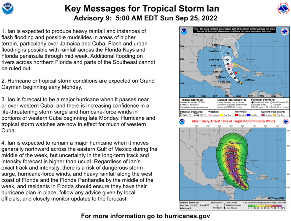
The National Hurricane Center says Tropical Storm Ian is headed for Cuba, then the Gulf of Mexico.
"On the forecast track, the center of Ian is forecast to pass well southwest of Jamaica today, and pass near or west of the Cayman Islands early Monday. Ian will then move near or over western Cuba Monday night and early Tuesday and emerge over the southeastern Gulf of Mexico on Tuesday."
Ian is forecast to just keep getting stronger.
"Rapid strengthening is forecast to begin later today. Ian is expected to become a hurricane later today or tonight and reach major hurricane strength by late Monday or Monday night before it reaches western Cuba."
 NHC
NHC
The Hurricane Center says models agree Ian will hit Florida, but disagree on where... with landfall forecast anywhere from south of Tampa all the way to the Florida/Alabama line.
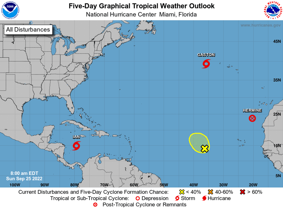
Elsewhere in the tropics, Hermine and Gaston are no threats to land. One other system in the Atlantic has just a 20% chance of formation in the next five days.
 NHC
NHC