


The National Hurricane Center says that while a tropical system along the Gulf Coast may not develop into a named storm, it will still bring some potentially flooding rains to Louisiana.
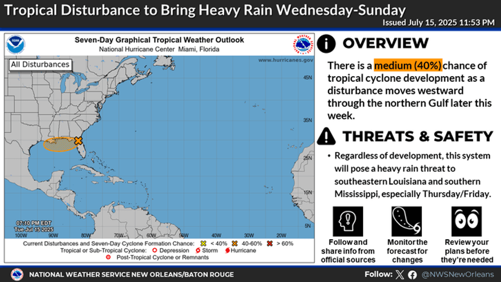
"Surface observations indicate that a broad area of low pressure continues to move westward across the Florida Panhandle," Senior Hurricane Specialist Philippe Papin advised. "This system is forecast to continue moving westward."
He says the center could get over the warm Gulf waters and allow some intensification, but only gives the system a 40% chance of becoming a named storm.
"If this system moves far enough offshore, environmental conditions over the Gulf appear generally favorable for additional development, and a tropical depression could still form."
Dr. Papin notes, however, that time is limited as the system is expected to move further inland on Friday.
"Regardless of development, heavy rainfall could produce localized flash flooding."
 NWS
NWS
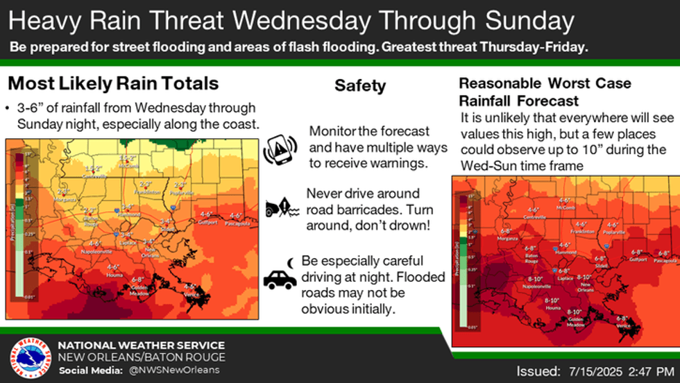
The National Weather Service has issued a flood watch from 1:00pm today through Friday night.
WWL TV Meteorologist Payton Malone says, "Most see between 2-4 inches with some spots over 6 inches, especially near the coast."
He notes that winds could be an issue too, especially if there is development.
"It still has a medium chance of developing into a depression or possibly a low-end tropical storm."
Dexter is the next name on the list.
Whatever it is, Malone says it will be a "sloppy rain maker."
 NWS
NWS


