

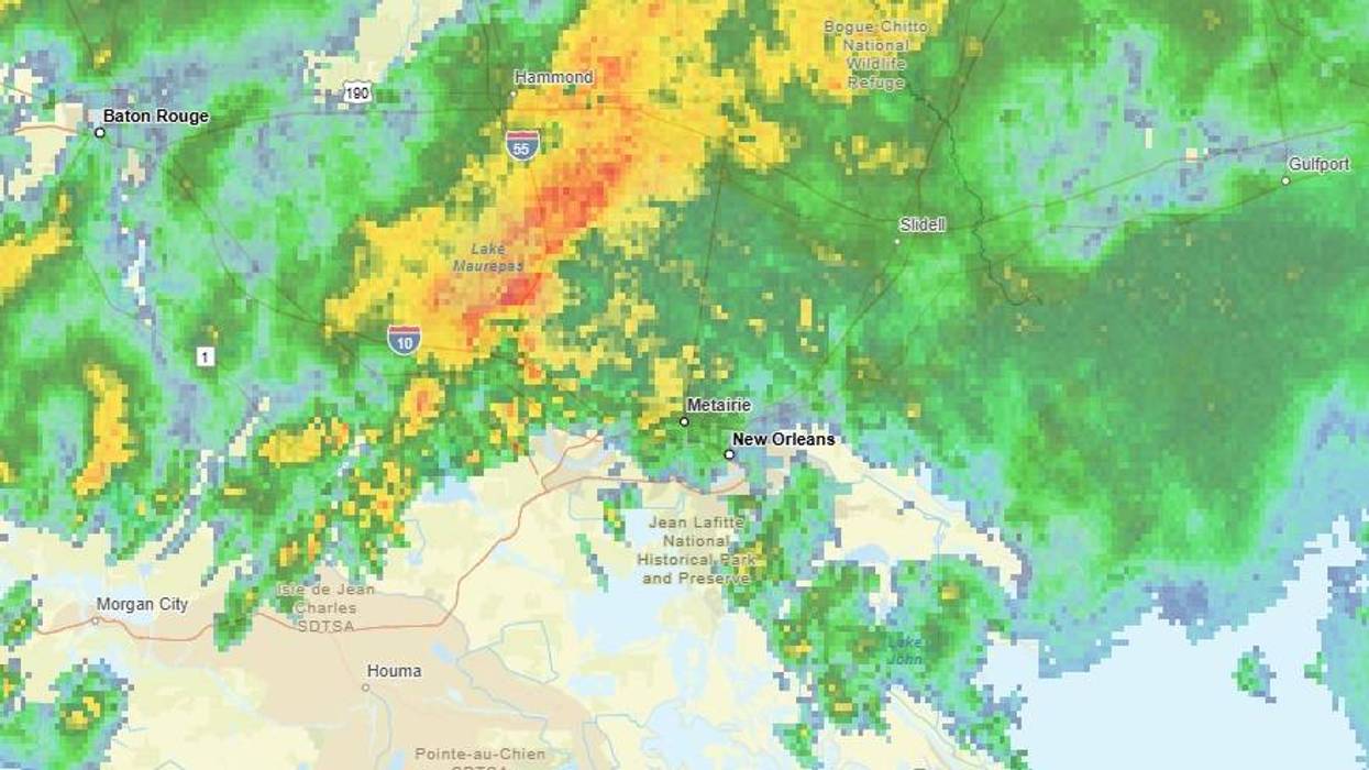

A line of storms began crossing Southeast Louisiana before dawn with winds gusting near 40 miles per hour and heavy rain.
By 6:00am, there were about 6,000 power outages from Baton Rouge to St. Tammany Parish.
“Expect heavy rain for your Thursday morning drive,” WWL TV Meteorologist Payton Malone advised. “The rain won’t be in a hurry to wrap up either, so expect a soggy morning.”
The Causeway was closed shortly after 7:00am due to the weather. It reopened around around 7:40am.
Malone said things would be better after 9:00am, but a few more storms could pop up into the afternoon.
New Orleans officials say parking is allowed on the neutral ground until 7:00pm.
The good news?
The rain will keep high temps in the mid 80s today.
Malone forecasts, “Friday and Saturday bring a few more storms, but not nearly as much rain across the area.”
Detailed Forecast:
TODAY:
Weather Impact Alert: Heavy rain from the morning to the early afternoon. High: 95. Winds: W 3-8.
FRIDAY:
Partly cloudy. 30-40% spotty to scattered showers, storms. Hot, humid. Low: S 77, N 74. High: 90.
SATURDAY:
Mostly sunny. Isolated shower. Hot, humid. Low: S 77, N 74. High: 92.
SUNDAY:
40% chance for rain. Hot, humid. Low: S 77, N 74. High: 92.
MONDAY:
Mostly sunny. Isolated shower. Hot, humid. Low: S 78, N 75. High: 92.
TUESDAY:
Partly cloudy, 30% spotty shower. Hot, humid. Low: S 78, N 75. High: 92.
WEDNESDAY:
Partly cloudy, 30% spotty shower. Hot, humid. Low: S 78, N 75. High: 92.