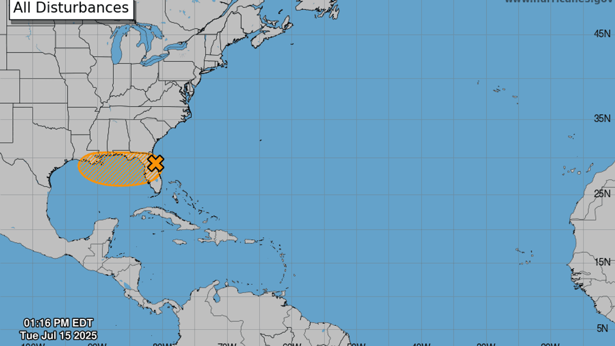
An area of disorganized showers and storms associated with a low pressure system off northeast Florida has a 40 percent chance of tropical cyclone development over the next two to seven days.
"Once the system reaches the northeastern Gulf on Wednesday, environmental conditions appear generally favorable for additional development, and a tropical depression could form while the system moves across the northeastern and north-central Gulf and approaches the coast of Louisiana on Thursday," said National Hurricane Center forecaster Jack Beven.
The system will likely bring heavy rain to the New Orleans area whether it develops of not.
"Really, regardless of development, we are expecting some heavy rain to get spread over the northern Gulf coast," said WWL-TV meteorologist Alexandra Cranford. "So for us, a flood watch begins Wednesday at 1 p.m., and lasts until at least Friday night."
Rainfall totals could be 3 to 6 inches through the weekend, but Alexandra says some areas could get as much as ten inches.