The cold front will arrive in Southeast Louisiana later today.
A few showers may precede that front, but if we do see any rain, it won't be much. Temperatures will peak at 70°, and then they'll rapidly decrease, falling into the mid- to upper-40s tonight and early tomorrow morning. That chill will stick around through Black Friday, with highs expected to be around 57°. Temperatures will near the 60-degree mark on Saturday, Sunday, and Monday before we see a slight warmup on Tuesday and Wednesday.
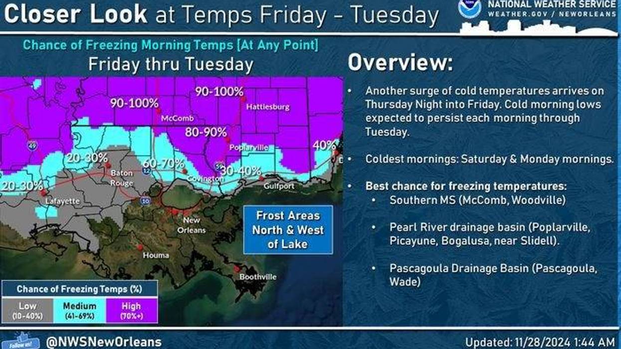
Parts of the Northshore will see overnight low temperatures in the mid-30s over the next few nights. That could lead to some frost and a possible light freeze. Make sure to protect your pets and plants. Pipes will be fine.
THANKSGIVING:
Warm early, falling temps through the late afternoon/evening. Scattered rain. Mostly cloudy. Breezy. Low: S 65, N 56. High: 70 early, then cooler late.
FRIDAY:
Sun and clouds. Chilly and windy. Low: S 49, N 45. High: 57.
SATURDAY:
AM frost north. Mostly sunny. Chilly. Low: S 45, N 36. High: 59.
SUNDAY:
AM frost north. Mostly sunny. Chilly. Low: S 46, N 36. High: 60.
MONDAY:
AM frost/light freeze north. Sunny and chilly. Low: S 45, N 35. High: 60.
TUESDAY:
AM frost/light freeze north. Mostly sunny. Cool. Low: S 46, N 35. High: 62.
WEDNESDAY:
Partly cloudy. Mild. A shower. Low: S 50, N 43. High: 67.