


Get ready for a few blasts of colder air across Southeast Louisiana.
"It will be very windy today with wind gusts 30-40 mph. By tonight temperatures will fall fast and most wake up Saturday morning in the 30s," WWL TV Meteorologist Payton Malone forecasts.
He says lows for the weekend will be around freezing north of the lake, with upper 30s and low 40s on the Southshore. Highs will be in the 50s.
"Next week brings the major cold front," Malone warns. "The Arctic air will slowly move in by Monday night."
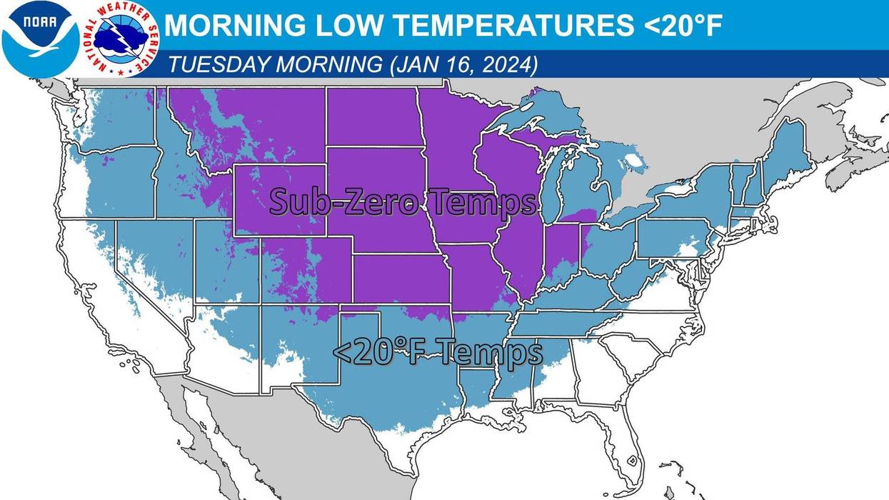
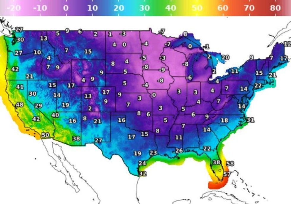
He says late Monday into early Tuesday will see the coldest air of the season yet. Look for 30 degrees Tuesday morning south of the lake with 25 on the Northshore. We won't even get to 40 degrees on Tuesday for a high.
 NWS
NWS
"It looks even older for Wednesday morning with temps in the teens and 20s, that would mean a hard freeze for BOTH sides of the Lake."
There is a chance of some freezing rain north of I-12 Monday night into Tuesday.
Detailed Forecast...
TODAY:
50% scattered showers and storms, ending before noon. Warmer early, then falling in afternoon. Windy. High: 71, 60s to 50s during the day.
SATURDAY:
Sunny and cold! Low: S 38, N 32. High: 54.
SUNDAY:
Mostly sunny to partly cloudy. Pleasant! Low: S 41, N 34. High: 59.
MLK DAY:
40% scattered showers. Chilly early, then dramatically colder air. Windy. Low: S 44, N 39. High: 54, then falling.
TUESDAY:
Little wintry mix early Northshore? Hard Freeze North. Partly cloudy early, then sunny. Windy. Low: S 30, N 25. High: 38.
WEDNESDAY:
Hard Freeze North & South. Mostly sunny, cold. Low: S 26, N 16. High: 41.
THURSDAY:
Freezing temps. Possible Hard Freeze North. Partly sunny. Chilly. Low: S 30, N 27. High: 52.


