After highs in the 70s and 80s this week, we end the week on a colder note.
"Today we only get to about 60 degrees," WWL TV Meteorologist Payton Malone forecasts. "Expect a cloudy and cool Friday, but it does look dry today."
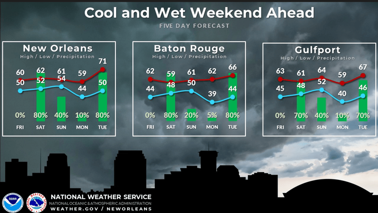
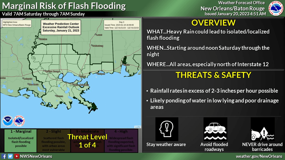
He says the weekend will bring showers throughout Saturday.
"The good news is there will be breaks in the rain, but expect to get rained on at some point Saturday. The chance lasts from the morning through the late evening hours. Most see between 1-2 inches of rain. No severe weather is expected."
 NWS
NWS
Malone says just a few showers stick around Sunday morning.
"A front will clear us out for Sunday with highs in the upper 50s. More sunshine and cool for Monday before another storm system moves in next Tuesday."
Detailed Forecast...
TODAY:
Becoming mostly cloudy. Isolated light shower. Cooler, less humid. High: 60.
SATURDAY:
70% numerous showers, some storms. Cool. Low: S 52, N 47. High: 57.
SUNDAY:
Some early AM rain, then ending. Mostly cloudy with some sunny breaks. Chilly. Low: S 55, N 52. High: 60.
MONDAY:
Sun to partly cloudy. Chilly. Low: S 45, N 37. High: 61.
TUESDAY:
60% chance for strong storms. Brief warm up. Breezy. Low: S 59, N 53. High: 71.
WEDNESDAY:
Early clouds, then sunny. Chilly and breezy. Low: S 44, N 38. High: 54.
THURSDAY:
Light freeze NS, MS. Mostly sunny. Chilly. Low: S 39, N 32. High: 56.