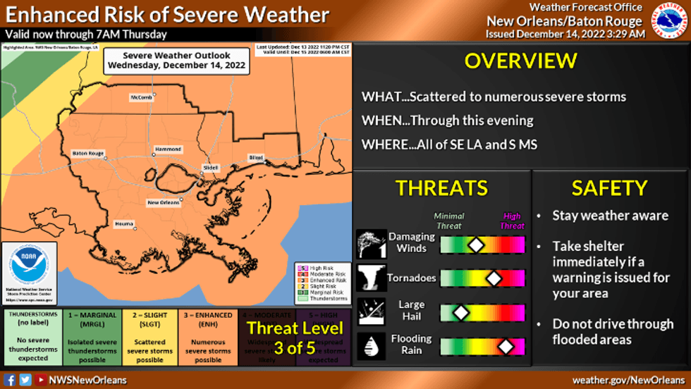
Severe weather is moving across the state of Louisiana today.
"By the lunchtime hours and continuing through the afternoon, storms are expected to become more widespread," WWL TV Meteorologist Payton Malone warned. "This afternoon is when the severe weather threat will be at its highest."
He says the line has already triggered deadly tornadoes to our north and west.
Southeast Louisiana today faces the following threats:
- High wind gusts of 60 mph or higher
- Tornadoes
- Heavy rain of 1-3 inches or more in spots
- Hail
 NWS
NWS
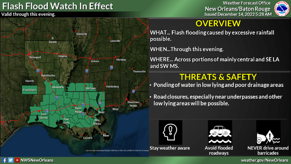
Malone says the bulk of the rain will fall in Southeast Louisiana from around Noon to 8:00pm.
"The worst of the severe weather looks like it moves through from around 2:00pm to 5:00pm for New Orleans and much of the Northshore."
 NWS
NWS
Things get colder behind the front.
Detailed Forecast...
TODAY:
100% chance of numerous showers and storms in the daytime through evening. Some strong to severe. Warm, humid and breezy. Low: S 68, N 66. High: 78.
THURSDAY:
Mostly sunny skies. Much cooler. Low: S 52, N 46. High: 60.
FRIDAY:
Sunny and chilly. Low: S 47, N 40. High: 61.
SATURDAY:
Partly cloudy and chilly. 40% chance of isolated showers. Low: S 46, N 39. High: 54.
SUNDAY
Partly cloudy, cool. Lows: S 44, N 31. High: 56.
MONDAY:
Mostly cloudy, breezy and cool. 40% chance of scattered showers. Lows: S 50, N 45. High: 60.
TUESDAY:
Mostly cloudy, breezy and cool. 30% chance of scattered showers. Lows: S 54, N 51. High: 62.