The National Hurricane Center is now predicting Hurricane Eta will stay further east in the Gulf of Mexico, and make landfall possibly north of Tampa around Thursday.
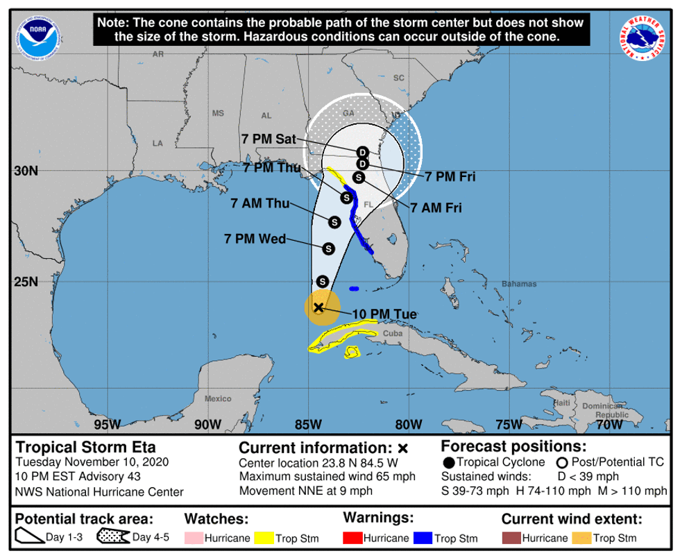
"Eta is moving toward the north-northeast near 9 mph," said Senior Hurricane Specialist Dan Brown. "On the forecast track the center of Eta will move closer to but offshore of the southwest coast of Florida on Wednesday, approach the west-central coast of Florida Wednesday night, and move inland over the northern portion of the Florida peninsula on Thursday."
The hurricane center has issued a tropical storm warning for the west coast of Florida from Bonita Beach to Suwannee River.