Today will be blustery and warm ahead of a cold front that could bring severe storms.
"Get ready for an active weather day as a powerful storm system moves our way out of Texas," WWL TV Meteorologist Payton Malone warned. "By this afternoon the main story will be the strong south winds kicking in. A High Wind Warning has been issued for our area."
He forecasts winds could gust to 50 mph through the afternoon and evening.
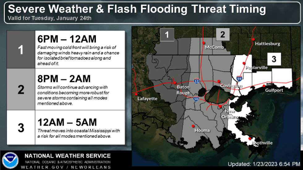
"The threat for storms and severe weather will come tonight as the cold front moves in. The timing will be after 9-10 pm for most."
 NWS
NWS
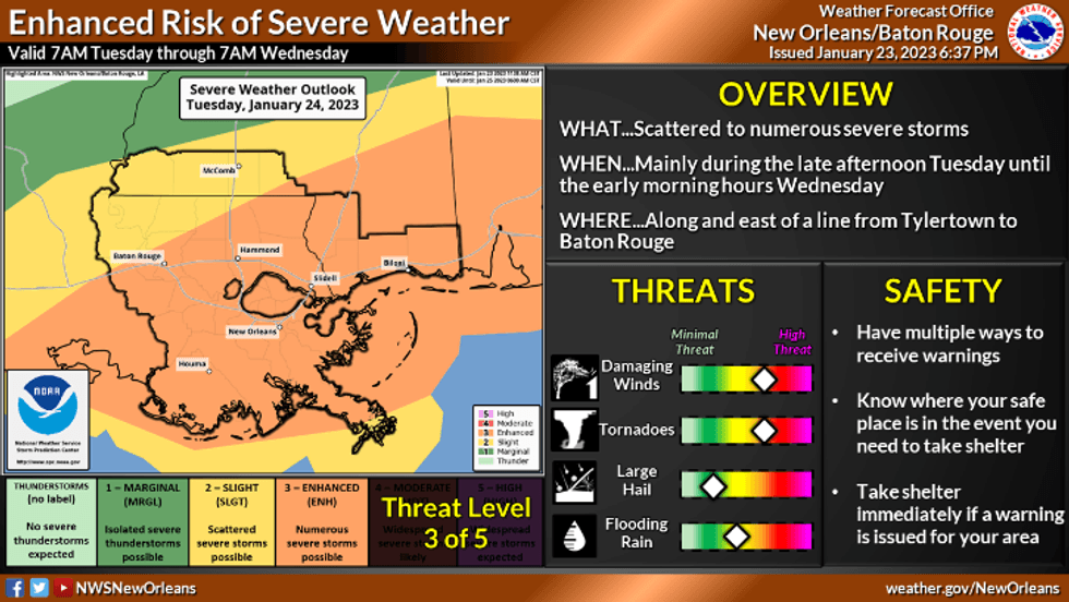
Malone says we could see damaging winds and a few tornadoes tonight.
 NWS
NWS
Tomorrow is chilly and breezy with lingering clouds. With the clouds some might struggle to get out of the upper 40s Wednesday afternoon.
Thursday and Friday are cool, but dry. This weekend the weather looks good for Saturday's parade, but anther round of rain is expected Sunday.
Detailed Forecast:
TODAY:
Increasing clouds. 30% afternoon, evening showers/storms, 100% late night and early morning strong to severe storms. Brief warm up late, windy. High: 66 in the afternoon warming to low 70s in the evening ahead of storms.
Winds: SE/S 20-30+
WEDNESDAY:
Mostly cloudy. Some sun late. Chilly, breezy. Low: S 50, N 48. High: 50.
THURSDAY:
Partly cloudy. Chilly. Low: S 40, N 35. High: 54.
FRIDAY:
Light freeze NS, MS. Mostly sunny. Chilly. Low: S 39, N 31. High: 58.
SATURDAY:
Chilly morning, pleasant afternoon. Mostly sunny to partly cloudy. Breezy. Low: S 45, N 39. High: 66.
SUNDAY:
60% numerous showers and storms. Milder temps, breezy. Low: S 57, N 53. High: 69.