Hurricane Ida has begun its forecast intensification now that it is in the Gulf of Mexico.
"Rapid strengthening is forecast during the next 24 to 36 hours and Ida is expected to be an extremely dangerous major hurricane," the National Hurricane Center advised.
As of 7:00am, top sustained winds had increased to 85 miles per hour. The Hurricane Center expects that will increase to 140mph.
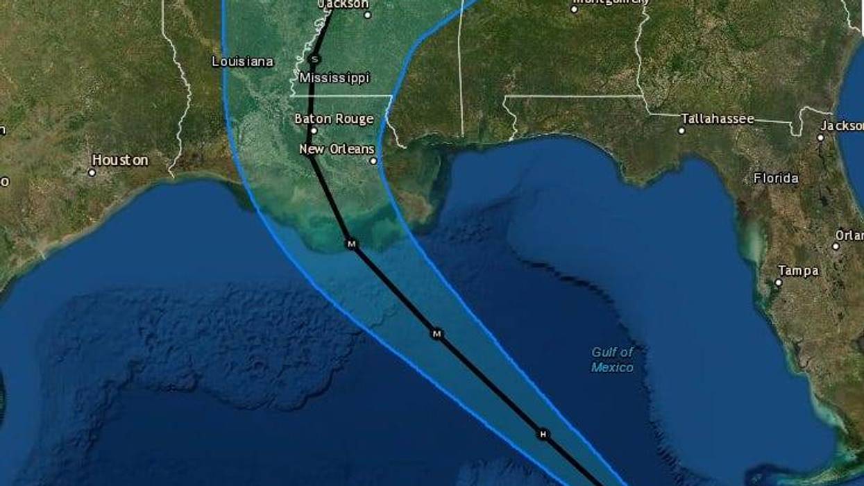
"On the forecast track, the center of Ida will move over the southeastern Gulf of Mexico today and move over the central Gulf of Mexico tonight and early Sunday. Ida is then expected to make landfall along the U.S. northern Gulf coast within the hurricane warning area on Sunday."
The eye is currently forecast to come ashore near Morgan City, Louisiana. If that track holds, Ida would have less severe impacts on the most populated areas of Southeast Louisiana. The path, however, could change. Any shifts to the east will increase what the New Orleans metro area experiences.
Where the worst of the impacts are felt, forecasters say it will be catastrophic damage.
The Hurricane Center says a category four hurricane leaves areas "uninhabitable" in its wake.
"Well-built framed homes can sustain severe damage with loss of most of the roof structure and/or some exterior walls. Most trees will be snapped or uprooted and power poles downed. Fallen trees and power poles will isolate residential areas. Power outages will last weeks to possibly months. Most of the area will be uninhabitable for weeks or months."

Mandatory evacuations are in place for everyone in St. Charles Parish, Lafourche Parish and Terrebonne Parish. Everyone outside the levee protection is also under a mandatory evacuation in Jefferson, Orleans, St. John, and Plaquemines.
The rest of the area is under a voluntary evacuation.