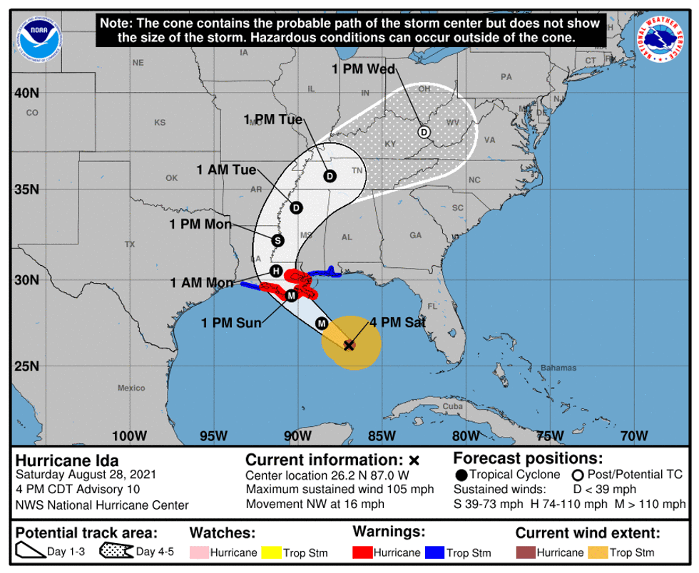
The National Hurricane Center says Hurricane Ida is quickly getting stronger in the Gulf of Mexico.
"The hurricane appears to have begun its anticipated rapid intensification phase," forecasters advised. "Maximum sustained winds have
increased to near 105 mph."
This intensification trend is expected to continue until landfall along the Louisiana coast.
"Additional rapid strengthening is forecast during the next 12 to 24 hours and Ida is expected to be an extremely dangerous major hurricane when it makes landfall along the Louisiana coast on Sunday."
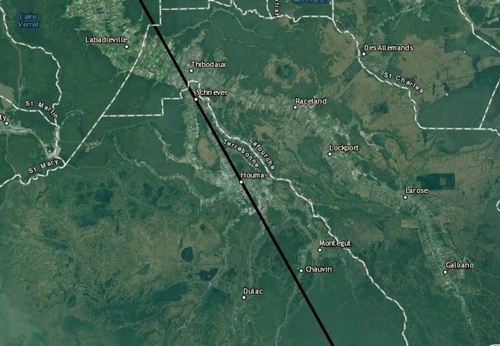
The forecast path has shifted slightly east and now calls for Ida's eye to hit near Chauvin and pass over Houma and Schriever before moving near Thiboduax on a track west of Baton Rouge.
Impacts will spread to either side of the eye.
Key Messages:
1. There is a danger of life-threatening storm surge inundation Sunday along the coasts of Louisiana, Mississippi, and Alabama within the Storm Surge Warning area. Extremely life-threatening inundation of 9 feet or greater above ground level is possible somewhere within the area from Morgan City, Louisiana, to the coast of Mississippi. Overtopping of local levees outside of the Hurricane and Storm Damage Risk Reduction System is possible where local inundation values may be higher. Interests throughout the warning area should follow any advice given by local officials.
2. Ida is expected to be an extremely dangerous major hurricane when it reaches the coast of Louisiana. Hurricane-force winds are expected Sunday in portions of the Hurricane Warning area along the Louisiana coast, including metropolitan New Orleans, with potentially catastrophic wind damage possible where the core of Ida moves onshore. Actions to protect life and property should be rushed to completion in the warning area.
3. Damaging winds, especially in gusts, will spread inland near the track of the center of Ida across portions of southeastern Louisiana and southwestern Mississippi Sunday night and early Monday. These winds will likely lead to widespread tree damage and power outages.
4. Ida is likely to produce heavy rainfall Sunday into Monday across the central Gulf Coast from southeast Louisiana, coastal Mississippi, and far southwestern Alabama, resulting in considerable to life-threatening flash and urban flooding and significant river flooding impacts. As Ida moves inland, significant flooding impacts are possible across portions of the Lower Mississippi, Tennessee, and Ohio Valleys through Wednesday.